|
search place name
|
||
Lütow (Sachsen-Anhalt, Germany)Lütow is a town in the Sachsen-Anhalt region of Germany. An overview map of the region around Lütow is displayed below.
regional and 3d topo map of Lütow, Germany ::

Lütow airports ::
The nearest airport is SZW - Schwerin Parchim, located 73.0 km north of Lütow.
Other airports nearby include TXL - Berlin Tegel (80.0 km east), THF - Berlin Tempelhof (91.0 km south east), SXF - Berlin Schonefeld (102.9 km south east), RLG - Laage (122.8 km north), Nearby towns ::
Vehlgast (2.2km south east) //
Waldfrieden (2.9km north east) //
Kuhlhausen (3.9km south) //
Wendisch Kirchhof (2.9km south east) //
Kümmernitz (4.3km north east) //
Damerow (3.4km east) //
Todtenkopf (3.8km north east) //
Jederitz (3.8km south west) //
Obermühl (5.7km north) //
Neuhaus (6.0km north) //
Damelack (7.5km north) //
Wöplitz (4.8km north west) //
Garz (7.5km south) //
Strodehne (6.5km south east) //
Müggenbusch (5.8km north west) //
Breddin (7.7km north) //
Vogtsbrügge (5.8km north east) //
Scheunstelle (5.8km south east) //
Neukamern (7.1km south west) //
Sophiendorf (7.1km north east) //
Kamern (8.7km south west) //
[all distances 'as the bird flies' and approximate] 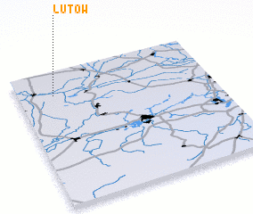 Places with similar names to Lütow, Germany ::
Disclaimer :: Information on this page comes without warranty of any kind |
||
|
Where is Lütow? Elevation and coordinates ::
Latitude (lat): 52°49'0"N Longitude (lon): 12°11'0"E
Elevation (approx.): 22m (map arrows pan, magnifying glasses zoom) |
||
|
Visiting Lütow? Hotel/Accommodation ::
Book a hotel in Lütow Travel Guide ::
Buy a travel guide for Germany rental cars ::
car rental offers GPS waypoint ::
download a GPX waypoint (PoI) of Lütow for your GPS receiver
|
||