|
search place name
|
||
Maltitz (Sachsen, Germany)Maltitz is a town in the Sachsen region of Germany. An overview map of the region around Maltitz is displayed below.
regional and 3d topo map of Maltitz, Germany ::

Maltitz airports ::
The nearest airport is DRS - Dresden, located 37.4 km east of Maltitz.
Other airports nearby include AOC - Altenburg Nobitz (53.1 km west), LEJ - Leipzig Halle (77.6 km north west), BBJ - Bautzen (90.4 km east), KLV - Karlovy Vary (104.1 km south), Nearby towns ::
Lüttewitz (0.0km north) //
Priesen (0.0km north) //
Markritz (1.9km north) //
Leschen (1.2km west) //
Petersberg (1.2km west) //
Prüfern (2.2km north west) //
Thal (2.2km north west) //
Neuwettersdorf (2.2km south west) //
Gertitzsch (2.2km south west) //
Dreißig (3.7km north) //
Beicha (3.7km north) //
Juchhöh (2.3km west) //
Stahna (2.3km east) //
Rüsseina (2.3km east) //
Wetterwitz (3.7km south) //
Gleisberg (3.7km south) //
Geleitshäuser (3.9km north) //
Präbschütz (3.0km north west) //
Gödelitz (3.9km north) //
Niederforst (3.0km south west) //
Theeschütz (3.0km south west) //
Praterschütz (3.0km north east) //
Neumutzschwitz (3.0km north east) //
Abend (3.0km north east) //
Wettersdorf (3.9km south) //
Neuseifersdorf (3.9km south) //
Choren (3.9km south) //
Starbach (3.0km south east) //
Dürrweitzschen (4.4km north west) //
[all distances 'as the bird flies' and approximate] 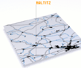 Places with similar names to Maltitz, Germany ::
Disclaimer :: Information on this page comes without warranty of any kind |
||
|
Where is Maltitz? Elevation and coordinates ::
Latitude (lat): 51°7'0"N Longitude (lon): 13°14'0"E
Elevation (approx.): 246m (map arrows pan, magnifying glasses zoom) |
||
|
Visiting Maltitz? Hotel/Accommodation ::
Book a hotel in Maltitz Travel Guide ::
Buy a travel guide for Germany rental cars ::
car rental offers GPS waypoint ::
download a GPX waypoint (PoI) of Maltitz for your GPS receiver
|
||