|
search place name
|
||
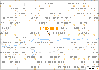
Marxheim (Bayern, Germany)Marxheim is a town in the Bayern region of Germany. An overview map of the region around Marxheim is displayed below.
regional and 3d topo map of Marxheim, Germany ::
Marxheim airports ::
The nearest airport is AGB - Augsburg, located 36.1 km south of Marxheim.
Other airports nearby include FEL - Fuerstenfeldbruck Furstenfeldbruck (64.9 km south), MUC - Munich Munchen (75.8 km south east), OBF - Oberpfaffenhofen (78.3 km south), NUE - Nuernberg Nurnberg (83.7 km north), Nearby towns ::
Schweinspoint (0.0km north) //
Bruck (1.9km south) //
Lechsend (2.4km west) //
Neuhausen (2.4km east) //
Neuhof (3.7km south) //
Niederschönenfeld (3.9km south) //
Gansheim (3.9km north) //
Feldheim (4.4km south west) //
Berg (5.6km north) //
Mittelstetten (5.6km south) //
Leitheim (3.7km west) //
Graisbach (3.7km west) //
Burgmannshofen (5.7km north) //
Erlbach (4.1km north east) //
Dünsberg (4.1km north east) //
Staudheim (6.1km south east) //
Trugenhofen (5.2km north east) //
Bertoldsheim (4.9km east) //
Blossenau (7.5km north) //
Tagmersheim (7.5km north) //
Quellgut (5.2km west) //
Altisheim (5.2km west) //
Daiting (6.7km north west) //
Ammerfeld (6.7km north east) //
Natterholz (7.8km north) //
Asbrunn (7.8km north) //
Gempfing (7.8km south) //
Genderkingen (7.4km south west) //
Hochfeld (7.4km north west) //
[all distances 'as the bird flies' and approximate]  Places with similar names to Marxheim, Germany ::
Disclaimer :: Information on this page comes without warranty of any kind |
||
|
Where is Marxheim? Elevation and coordinates ::
Latitude (lat): 48°45'0"N Longitude (lon): 10°57'0"E
Elevation (approx.): 427m (map arrows pan, magnifying glasses zoom) |
||
|
Visiting Marxheim? Hotel/Accommodation ::
Book a hotel in Marxheim Travel Guide ::
Buy a travel guide for Germany rental cars ::
car rental offers GPS waypoint ::
download a GPX waypoint (PoI) of Marxheim for your GPS receiver
|
||