|
search place name
|
||
Mellenthin (Mecklenburg-Vorpommern, Germany)Mellenthin is a town in the Mecklenburg-Vorpommern region of Germany. An overview map of the region around Mellenthin is displayed below.
regional and 3d topo map of Mellenthin, Germany ::

Mellenthin airports ::
The nearest airport is SZZ - Szczechin Goleniow, located 69.1 km south east of Mellenthin.
Other airports nearby include RLG - Laage (114.2 km west), RNN - Bornholm Ronne (136.4 km north), TXL - Berlin Tegel (158.7 km south), THF - Berlin Tempelhof (165.8 km south), Nearby towns ::
Neppermin (2.2km north east) //
Balm (3.7km north) //
Prätenow (4.3km south east) //
Gummlin (5.6km south) //
Suckow (3.3km west) //
Labömitz (3.3km east) //
Benz (3.8km north east) //
Morgenitz (3.8km north west) //
Stolpe (5.7km south) //
Katschow (3.8km south east) //
Kachlin (3.8km south east) //
Dewichow (4.9km north west) //
Stoben (4.9km north east) //
Dargen (4.9km south east) //
Krienke (4.7km north west) //
Pudagla (6.5km north east) //
Grüssow (8.1km north west) //
Welzin (8.1km south west) //
Reestow (8.6km north west) //
[all distances 'as the bird flies' and approximate] 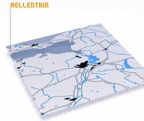 Places with similar names to Mellenthin, Germany ::
// Melánthion (GR)
Disclaimer :: Information on this page comes without warranty of any kind |
||
|
Where is Mellenthin? Elevation and coordinates ::
Latitude (lat): 53°55'0"N Longitude (lon): 14°1'0"E
Elevation (approx.): 22m (map arrows pan, magnifying glasses zoom) |
||
|
Visiting Mellenthin? Hotel/Accommodation ::
Book a hotel in Mellenthin Travel Guide ::
Buy a travel guide for Germany rental cars ::
car rental offers GPS waypoint ::
download a GPX waypoint (PoI) of Mellenthin for your GPS receiver
|
||