|
search place name
|
||
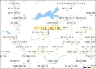
Mittelenztal (Baden-Württemberg, Germany)Mittelenztal is a town in the Baden-Württemberg region of Germany. An overview map of the region around Mittelenztal is displayed below.
regional and 3d topo map of Mittelenztal, Germany ::
Mittelenztal airports ::
The nearest airport is ZCC - Baden-baden Baden Oos, located 25.9 km north west of Mittelenztal.
Other airports nearby include STR - Stuttgart (55.8 km east), SXB - Strassbourg Entzheim (63.1 km west), ZQC - Speyer (72.6 km north), ZQL - Donaueschingen Villingen (75.4 km south), Nearby towns ::
Lappach (0.0km north) //
Rohnbach (1.2km west) //
Enzklösterle (2.2km north east) //
Gompelscheuer (2.2km south west) //
Süßbächle (2.4km west) //
Nonnenmiß (3.9km north) //
Kohlhäusle (4.4km north east) //
Eisenbach (5.7km south) //
Aichelberg (4.1km north east) //
Simmersfeld (5.2km south east) //
Fünfbronn (6.1km south east) //
Sprollenhaus (6.1km north east) //
Urnagold (6.1km south west) //
Göttelfingen (7.4km south) //
Allmandle (7.4km south) //
Oberweiler (5.2km east) //
Aichhalden (5.2km east) //
Hochdorf (7.8km south) //
Schorrental (7.8km south) //
Christophshof (7.4km north east) //
Besenfeld (8.3km south west) //
[all distances 'as the bird flies' and approximate]  Places with similar names to Mittelenztal, Germany :: Disclaimer :: Information on this page comes without warranty of any kind |
||
|
Where is Mittelenztal? Elevation and coordinates ::
Latitude (lat): 48°39'0"N Longitude (lon): 8°28'0"E
Elevation (approx.): 840m (map arrows pan, magnifying glasses zoom) |
||
|
Visiting Mittelenztal? Hotel/Accommodation ::
Book a hotel in Mittelenztal Travel Guide ::
Buy a travel guide for Germany rental cars ::
car rental offers GPS waypoint ::
download a GPX waypoint (PoI) of Mittelenztal for your GPS receiver
|
||