|
search place name
|
||
Niederindling (Bayern, Germany)Niederindling is a town in the Bayern region of Germany. An overview map of the region around Niederindling is displayed below.
regional and 3d topo map of Niederindling, Germany ::

Niederindling airports ::
The nearest airport is LNZ - Linz (Horsching), located 64.2 km east of Niederindling.
Other airports nearby include SZG - Salzburg (74.4 km south), MUC - Munich Munchen (117.3 km west), PRG - Prague Ruzyne (198.3 km north), KLV - Karlovy Vary (201.4 km north), Nearby towns ::
Schnellham (1.2km east) //
Oberindling (1.2km west) //
Rottau (2.2km north west) //
Reisting (2.2km south east) //
Eholfing (3.7km north) //
Sembauer (2.5km west) //
Gstetten (2.5km west) //
Afham (3.1km north east) //
Mittich (3.1km north east) //
Hartkirchen (3.1km south east) //
Inzing (3.1km south east) //
Rottersham (3.9km north) //
Ruhstorf (3.1km north west) //
Haar (3.9km south) //
Beham (3.9km south) //
Schlupfing (3.1km south west) //
Wolfing (3.1km south west) //
Pfaffing (3.9km south) //
Wollham (4.4km south west) //
Unterreuten (5.6km south) //
Voglöd (5.6km south) //
Berging (5.6km north) //
Oberreuten (5.7km south) //
Sulzbach am Inn (5.7km north) //
Gögging (5.7km south) //
Trostling (4.1km north west) //
Rotthof (4.1km north west) //
Riedhof (4.1km north west) //
Mattau (4.1km north east) //
[all distances 'as the bird flies' and approximate] 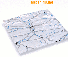 Places with similar names to Niederindling, Germany :: Disclaimer :: Information on this page comes without warranty of any kind |
||
|
Where is Niederindling? Elevation and coordinates ::
Latitude (lat): 48°25'0"N Longitude (lon): 13°22'0"E
Elevation (approx.): 316m (map arrows pan, magnifying glasses zoom) |
||
|
Visiting Niederindling? Hotel/Accommodation ::
Book a hotel in Niederindling Travel Guide ::
Buy a travel guide for Germany rental cars ::
car rental offers GPS waypoint ::
download a GPX waypoint (PoI) of Niederindling for your GPS receiver
|
||