|
search place name
|
||
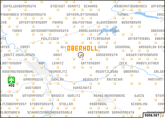
Oberhöll (Bayern, Germany)Oberhöll is a town in the Bayern region of Germany. An overview map of the region around Oberhöll is displayed below.
regional and 3d topo map of Oberhöll, Germany ::
Oberhöll airports ::
The nearest airport is HOQ - Hof Plauen, located 11.5 km south west of Oberhöll.
Other airports nearby include BYU - Bayreuth (46.6 km south west), KLV - Karlovy Vary (66.8 km east), AOC - Altenburg Nobitz (80.5 km north east), ERF - Erfurt (103.0 km north west), Nearby towns ::
Oberhartmannsreuth (0.0km north) //
Unterhöll (0.0km north) //
Neugattendorf (1.9km south) //
Schloßgattendorf (1.9km south) //
Neuenreuth (1.2km west) //
Vordereggeten (1.2km east) //
Waldfrieden (1.2km west) //
Troschenreuth (1.9km north) //
Gattendorf (2.2km south east) //
Döberlitz (2.2km south west) //
Kirchgattendorf (2.2km south east) //
Gumpertsreuth (2.2km north west) //
Loddenreuth (2.2km north east) //
Wiedersberg (3.7km north) //
Blosenberg (3.7km north) //
Sachsgrün (3.0km north east) //
Ullitz (3.0km north west) //
Vierschau (3.9km south) //
Ebersberg (3.9km north) //
Neutauperlitz (4.4km south west) //
Zettlarsgrün (4.4km north east) //
Ziegelhütten (4.4km north west) //
Heinersgrün (5.6km north) //
Gassenreuth (3.5km east) //
Haidt (3.5km west) //
Trogenau (4.0km south east) //
Leimitz (4.0km south west) //
Jägersruh (4.0km south west) //
Henriettenlust (4.0km south east) //
[all distances 'as the bird flies' and approximate] 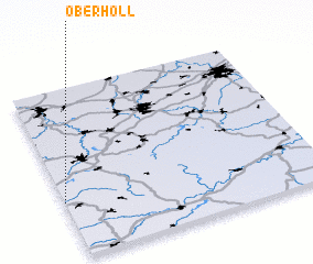 Places with similar names to Oberhöll, Germany ::
Disclaimer :: Information on this page comes without warranty of any kind |
||
|
Where is Oberhöll? Elevation and coordinates ::
Latitude (lat): 50°20'0"N Longitude (lon): 12°0'0"E
Elevation (approx.): 543m (map arrows pan, magnifying glasses zoom) |
||
|
Visiting Oberhöll? Hotel/Accommodation ::
Book a hotel in Oberhöll Travel Guide ::
Buy a travel guide for Germany rental cars ::
car rental offers GPS waypoint ::
download a GPX waypoint (PoI) of Oberhöll for your GPS receiver
|
||