|
search place name
|
||
Oberzwota (Sachsen, Germany)Oberzwota is a town in the Sachsen region of Germany. An overview map of the region around Oberzwota is displayed below.
regional and 3d topo map of Oberzwota, Germany ::

Oberzwota airports ::
The nearest airport is HOQ - Hof Plauen, located 37.1 km west of Oberzwota.
Other airports nearby include KLV - Karlovy Vary (42.4 km south east), BYU - Bayreuth (66.0 km south west), AOC - Altenburg Nobitz (71.0 km north), LEJ - Leipzig Halle (120.7 km north), Nearby towns ::
Gopplasgrün (1.9km south) //
Zwotental (1.9km north) //
Nordhausen (2.2km south west) //
Friebus (2.2km south west) //
Zechenbach (2.4km east) //
Sommerberg (2.4km east) //
Hetzschen (3.7km south) //
Erlbach (3.7km south) //
Gunzen (2.4km west) //
Kegel (3.9km south) //
Schlosserberg (3.0km north east) //
Wohlhausen (3.9km south) //
Kottenheide (4.4km north east) //
Bockmühlen (4.4km north west) //
Platten (4.4km south west) //
Wohlbach (3.5km west) //
Wernitzgrün (5.6km south) //
Eubabrunn (5.7km south) //
Eschenbach (4.0km north west) //
Bernitzgrün (4.0km south west) //
Schöneck (5.1km north west) //
Markneukirchen (5.1km south west) //
Počátky (5.1km south east) //
Pöhl (6.0km north west) //
Berghäuser (6.0km south west) //
Saalig (5.1km west) //
Birkenhäuser (6.6km north west) //
Kámen (6.6km south east) //
Kostelní (6.6km south east) //
[all distances 'as the bird flies' and approximate] 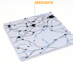 Places with similar names to Oberzwota, Germany :: Disclaimer :: Information on this page comes without warranty of any kind |
||
|
Where is Oberzwota? Elevation and coordinates ::
Latitude (lat): 50°21'0"N Longitude (lon): 12°22'0"E
Elevation (approx.): 705m (map arrows pan, magnifying glasses zoom) |
||
|
Visiting Oberzwota? Hotel/Accommodation ::
Book a hotel in Oberzwota Travel Guide ::
Buy a travel guide for Germany rental cars ::
car rental offers GPS waypoint ::
download a GPX waypoint (PoI) of Oberzwota for your GPS receiver
|
||