|
search place name
|
||
Ohmes (Hessen, Germany)Ohmes is a town in the Hessen region of Germany. An overview map of the region around Ohmes is displayed below.
regional and 3d topo map of Ohmes, Germany ::

Ohmes airports ::
The nearest airport is ZNF - Hanau Aaf, located 68.0 km south of Ohmes.
Other airports nearby include KSF - Kassel Calden (72.9 km north), FRA - Frankfurt Main (93.5 km south west), PAD - Paderborn Lippstadt (101.8 km north), ZCA - Arnsberg Menden (119.3 km north west), Nearby towns ::
Ruhlkirchen (2.2km north east) //
Angenrod (2.3km east) //
Heimertshausen (3.7km south) //
Seibelsdorf (3.0km north east) //
Arnshain (3.9km north) //
Billertshausen (3.0km south east) //
Ober-Gleen (3.0km south west) //
Zell (4.4km south east) //
Bernsburg (5.6km north) //
Vockenrod (3.5km east) //
Kirtorf (3.5km west) //
Wahlen (5.1km north west) //
Leusel (5.0km east) //
Fischbach (6.6km north east) //
Gleimenhain (6.6km north west) //
Romrod (6.6km south east) //
Ehringshausen (8.2km south west) //
Oberndorf (8.2km south west) //
[all distances 'as the bird flies' and approximate] 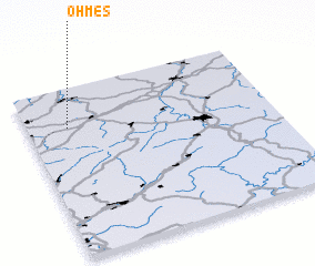 Places with similar names to Ohmes, Germany ::
Disclaimer :: Information on this page comes without warranty of any kind |
||
|
Where is Ohmes? Elevation and coordinates ::
Latitude (lat): 50°46'0"N Longitude (lon): 9°10'0"E
Elevation (approx.): 321m (map arrows pan, magnifying glasses zoom) |
||
|
Visiting Ohmes? Hotel/Accommodation ::
Book a hotel in Ohmes Travel Guide ::
Buy a travel guide for Germany rental cars ::
car rental offers GPS waypoint ::
download a GPX waypoint (PoI) of Ohmes for your GPS receiver
|
||