|
search place name
|
||
Osterkam (Bayern, Germany)Osterkam is a town in the Bayern region of Germany. An overview map of the region around Osterkam is displayed below.
regional and 3d topo map of Osterkam, Germany ::

Osterkam airports ::
The nearest airport is SZG - Salzburg, located 57.8 km east of Osterkam.
Other airports nearby include MUC - Munich Munchen (70.0 km north west), OBF - Oberpfaffenhofen (77.6 km north west), FEL - Fuerstenfeldbruck Furstenfeldbruck (85.1 km north west), INN - Innsbruck (89.9 km south west), Nearby towns ::
Eßbaum (0.0km north) //
Speckbach (0.0km north) //
Holling (0.0km north) //
Höhenmoos (1.2km west) //
Entbuch (1.2km west) //
Grainbach (1.9km south) //
Haus (1.9km south) //
Eiding (1.9km south) //
Acherting (1.2km east) //
Wessen (1.2km east) //
Thal (1.2km east) //
Riedlach (1.2km east) //
Ranhartstetten (1.2km east) //
Thalham (1.9km north) //
Schmidham (1.9km north) //
Patting (1.9km north) //
Geisenkam (2.2km south west) //
Samerberg (2.2km south west) //
Fading (2.2km south west) //
Törwang (2.2km south west) //
Achenmühle (2.2km south west) //
Ried (2.2km south east) //
Bichl (2.2km south east) //
Stuhlrain (2.2km north east) //
Hetzenbichl (2.2km north east) //
Kohlstatt (2.2km north east) //
Hilgen (3.7km south) //
Unterapfelkam (2.5km west) //
Oberapfelkam (2.5km west) //
[all distances 'as the bird flies' and approximate] 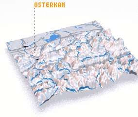 Places with similar names to Osterkam, Germany :: Disclaimer :: Information on this page comes without warranty of any kind |
||
|
Where is Osterkam? Elevation and coordinates ::
Latitude (lat): 47°48'0"N Longitude (lon): 12°14'0"E
Elevation (approx.): 561m (map arrows pan, magnifying glasses zoom) |
||
|
Visiting Osterkam? Hotel/Accommodation ::
Book a hotel in Osterkam Travel Guide ::
Buy a travel guide for Germany rental cars ::
car rental offers GPS waypoint ::
download a GPX waypoint (PoI) of Osterkam for your GPS receiver
|
||