|
search place name
|
||
Pfofeld (Bayern, Germany)Pfofeld is a town in the Bayern region of Germany. An overview map of the region around Pfofeld is displayed below.
regional and 3d topo map of Pfofeld, Germany ::

Pfofeld airports ::
The nearest airport is NUE - Nuernberg Nurnberg, located 45.8 km north of Pfofeld.
Other airports nearby include AGB - Augsburg (77.2 km south), GHF - Giebelstadt Aaf (86.3 km north west), FEL - Fuerstenfeldbruck Furstenfeldbruck (106.2 km south), MUC - Munich Munchen (110.0 km south east), Nearby towns ::
Gundelshalm (0.0km north) //
Langlau (1.2km east) //
Rehenbühl (2.2km north east) //
Geiselsberg (3.7km north) //
Frickenfelden (2.4km west) //
Dornhausen (3.7km south) //
Wachstein (3.7km south) //
Brombach (3.9km north) //
Röthenhof (3.9km north) //
Obenbrunn (3.1km south west) //
Müssighof (3.1km north east) //
Rittern (3.1km south east) //
Windsfeld (4.4km south west) //
Gräfensteinberg (5.7km north) //
Igelsbach (5.7km north) //
Oberasbach (4.1km south west) //
Unterasbach (4.1km south west) //
Geislohe (5.2km north west) //
Absberg (5.2km north east) //
Stopfenheim (5.2km south east) //
Obererlbach (7.4km north) //
Thannhausen (4.9km east) //
Regelsberg (4.9km east) //
Ehlheim (7.4km south) //
Gundelsheim (7.4km south) //
Laubenzedel (5.2km west) //
Sinderlach (5.2km west) //
Untererlbach (7.5km north) //
Kalbensteinberg (7.5km north) //
[all distances 'as the bird flies' and approximate] 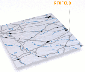 Places with similar names to Pfofeld, Germany :: Disclaimer :: Information on this page comes without warranty of any kind |
||
|
Where is Pfofeld? Elevation and coordinates ::
Latitude (lat): 49°7'0"N Longitude (lon): 10°50'0"E
Elevation (approx.): 492m (map arrows pan, magnifying glasses zoom) |
||
|
Visiting Pfofeld? Hotel/Accommodation ::
Book a hotel in Pfofeld Travel Guide ::
Buy a travel guide for Germany rental cars ::
car rental offers GPS waypoint ::
download a GPX waypoint (PoI) of Pfofeld for your GPS receiver
|
||