|
search place name
|
||
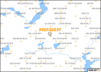
Premsdorf (Brandenburg, Germany)Premsdorf is a town in the Brandenburg region of Germany. An overview map of the region around Premsdorf is displayed below.
regional and 3d topo map of Premsdorf, Germany ::
Premsdorf airports ::
The nearest airport is SXF - Berlin Schonefeld, located 45.0 km north west of Premsdorf.
Other airports nearby include THF - Berlin Tempelhof (57.5 km north west), TXL - Berlin Tegel (69.6 km north west), BBJ - Bautzen (112.4 km south), DRS - Dresden (117.1 km south), Nearby towns ::
Ahrensdorf (0.0km north) //
Görsdorf (2.2km south east) //
Glienicke (3.7km north) //
Behrensdorf (2.9km north west) //
Schwenow (2.9km south west) //
Wulfersdorf (2.9km south east) //
Möllendorf (3.4km west) //
Falkenberg (3.4km east) //
Kossenblatt (5.7km south) //
Behrensdorf Siedlung (3.9km north west) //
Lindenberg (5.0km north east) //
Herzberg (6.0km north) //
Briescht (6.0km south) //
Giesensdorf (5.0km south east) //
Limsdorf (4.5km west) //
Werder (6.5km south west) //
Radlow (7.8km north) //
Diensdorf-Radlow (7.8km north) //
Neue Mühle (5.9km north west) //
Wendisch Rietz (5.9km north west) //
Braunberg (7.8km north) //
Plattkow (8.7km south west) //
[all distances 'as the bird flies' and approximate]  Places with similar names to Premsdorf, Germany ::
// Pramsdorf (DE)
Disclaimer :: Information on this page comes without warranty of any kind |
||
|
Where is Premsdorf? Elevation and coordinates ::
Latitude (lat): 52°10'0"N Longitude (lon): 14°5'0"E
Elevation (approx.): 65m (map arrows pan, magnifying glasses zoom) |
||
|
Visiting Premsdorf? Hotel/Accommodation ::
Book a hotel in Premsdorf Travel Guide ::
Buy a travel guide for Germany rental cars ::
car rental offers GPS waypoint ::
download a GPX waypoint (PoI) of Premsdorf for your GPS receiver
|
||