|
search place name
|
||
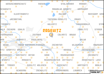
Radewitz (Sachsen, Germany)Radewitz is a town in the Sachsen region of Germany. An overview map of the region around Radewitz is displayed below.
regional and 3d topo map of Radewitz, Germany ::
Radewitz airports ::
The nearest airport is DRS - Dresden, located 34.0 km south east of Radewitz.
Other airports nearby include AOC - Altenburg Nobitz (73.7 km south west), BBJ - Bautzen (79.7 km east), LEJ - Leipzig Halle (81.4 km west), SXF - Berlin Schonefeld (116.8 km north), Nearby towns ::
Marksiedlitz (1.2km west) //
Glaubitz (2.2km south west) //
Sageritz (2.2km south west) //
Langenberg (2.2km south west) //
Peritz (2.2km north east) //
Colmnitz (2.3km east) //
Leckwitz (3.7km south) //
Nünchritz (3.7km south) //
Streumen (3.7km north) //
Wülknitz (3.7km north) //
Zschaiten (3.9km south) //
Roda (4.4km south east) //
Grödel (4.4km south west) //
Tiefenau (5.6km north) //
Zeithain (3.5km west) //
Vogelberg (3.9km south west) //
Moritz (3.9km south west) //
Schänitz (5.7km south) //
Naundörfchen (5.7km south) //
Koselitz (6.0km north east) //
Lichtensee (6.0km north west) //
Haidehäuser (6.0km north west) //
Leutewitz (6.0km south west) //
Boritz (7.4km south) //
Althirschstein (7.4km south) //
Bauda (4.6km east) //
Gosa (7.5km south) //
Kleinleckwitz (7.5km south) //
Merschwitz (7.5km south) //
[all distances 'as the bird flies' and approximate]  Places with similar names to Radewitz, Germany ::
Disclaimer :: Information on this page comes without warranty of any kind |
||
|
Where is Radewitz? Elevation and coordinates ::
Latitude (lat): 51°20'0"N Longitude (lon): 13°24'0"E
Elevation (approx.): 122m (map arrows pan, magnifying glasses zoom) |
||
|
Visiting Radewitz? Hotel/Accommodation ::
Book a hotel in Radewitz Travel Guide ::
Buy a travel guide for Germany rental cars ::
car rental offers GPS waypoint ::
download a GPX waypoint (PoI) of Radewitz for your GPS receiver
|
||