|
search place name
|
||
Rheinsberg-Glienicke (Brandenburg, Germany)Rheinsberg-Glienicke is a town in the Brandenburg region of Germany. An overview map of the region around Rheinsberg-Glienicke is displayed below.
regional and 3d topo map of Rheinsberg-Glienicke, Germany ::

Rheinsberg-Glienicke airports ::
The nearest airport is TXL - Berlin Tegel, located 66.5 km south east of Rheinsberg-Glienicke.
Other airports nearby include SZW - Schwerin Parchim (76.9 km north west), THF - Berlin Tempelhof (78.8 km south east), SXF - Berlin Schonefeld (91.9 km south east), RLG - Laage (100.2 km north), Nearby towns ::
Gühlen Glienicke (1.9km south) //
Steinberge (3.7km south) //
Neuglienicke (2.2km west) //
Binenwalde (2.9km south east) //
Boltenmühle (4.3km south east) //
Basdorf (4.3km north west) //
Wallitz (5.6km north) //
Zühlen (3.8km north east) //
Zechlin Dorf (7.4km north) //
Kunkelberg (7.5km north) //
Braunsberg (4.8km south east) //
Möckern (6.5km north east) //
Linow (5.8km north east) //
Kagar (8.1km north east) //
Frankendorf (7.1km south west) //
Stendenitz (8.7km south east) //
Zermützel (8.7km south east) //
[all distances 'as the bird flies' and approximate] 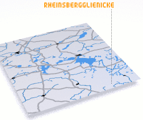 Places with similar names to Rheinsberg-Glienicke, Germany :: Disclaimer :: Information on this page comes without warranty of any kind |
||
|
Where is Rheinsberg-Glienicke? Elevation and coordinates ::
Latitude (lat): 53°4'0"N Longitude (lon): 12°46'0"E
Elevation (approx.): 93m (map arrows pan, magnifying glasses zoom) |
||
|
Visiting Rheinsberg-Glienicke? Hotel/Accommodation ::
Book a hotel in Rheinsberg-Glienicke Travel Guide ::
Buy a travel guide for Germany rental cars ::
car rental offers GPS waypoint ::
download a GPX waypoint (PoI) of Rheinsberg-Glienicke for your GPS receiver
|
||