|
search place name
|
||
Rurberg (Nordrhein-Westfalen, Germany)Rurberg is a town in the Nordrhein-Westfalen region of Germany. An overview map of the region around Rurberg is displayed below.
regional and 3d topo map of Rurberg, Germany ::

Rurberg airports ::
The nearest airport is GKE - Geilenkirchen, located 45.2 km north west of Rurberg.
Other airports nearby include MST - Maastricht (54.3 km north west), CGN - Cologne Koln Bonn (60.4 km north east), LGG - Liege (66.6 km west), MGL - Moenchengladbach Monchengladbach (68.8 km north), Nearby towns ::
Woffelsbach (0.0km north) //
Einruhr (3.7km south) //
Steckenborn (3.0km north west) //
Dedenborn (4.4km south west) //
Rollesbroich (4.0km north west) //
Strauch (4.0km north west) //
Erkensruhr (5.7km south) //
Kommerscheidt (5.7km north) //
Froitscheidt (5.7km north) //
Schmidt (5.7km north) //
Kesternich (4.0km south west) //
Simonskall (6.0km north west) //
Rauchenauel (6.0km south west) //
Harscheidt (6.0km north east) //
Wollseifen (5.1km south east) //
Witzerath (4.7km west) //
Vossenack (7.5km north) //
Hasenfeld (5.1km east) //
Kallbrück (6.6km north west) //
Germeter (7.8km north) //
Huppenbroich (6.0km south west) //
Schwammenauel (6.0km north east) //
Dreiborn (7.8km south) //
Hammer (7.3km south west) //
Morsbach (7.3km south east) //
Herhahn (8.8km south east) //
[all distances 'as the bird flies' and approximate] 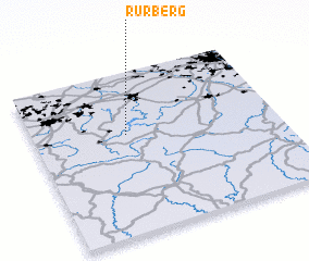 Places with similar names to Rurberg, Germany ::
Disclaimer :: Information on this page comes without warranty of any kind |
||
|
Where is Rurberg? Elevation and coordinates ::
Latitude (lat): 50°37'0"N Longitude (lon): 6°23'0"E
Elevation (approx.): 317m (map arrows pan, magnifying glasses zoom) |
||
|
Visiting Rurberg? Hotel/Accommodation ::
Book a hotel in Rurberg Travel Guide ::
Buy a travel guide for Germany rental cars ::
car rental offers GPS waypoint ::
download a GPX waypoint (PoI) of Rurberg for your GPS receiver
|
||