|
search place name
|
||
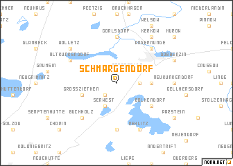
Schmargendorf (Brandenburg, Germany)Schmargendorf is a town in the Brandenburg region of Germany. An overview map of the region around Schmargendorf is displayed below.
regional and 3d topo map of Schmargendorf, Germany ::
Schmargendorf airports ::
The nearest airport is TXL - Berlin Tegel, located 65.0 km south west of Schmargendorf.
Other airports nearby include THF - Berlin Tempelhof (67.7 km south west), SXF - Berlin Schonefeld (73.1 km south west), SZZ - Szczechin Goleniow (92.3 km north east), RLG - Laage (152.2 km north west), Nearby towns ::
Klein Ziethen (2.2km south west) //
Sternfelde (2.2km north east) //
Herzsprung (2.2km east) //
Serwest (3.9km south) //
Augustenfelde (3.3km east) //
Groß Ziethen (3.8km south west) //
Bölkendorf (5.0km south east) //
Brodowin (7.4km south) //
Weißensee (7.4km south) //
Görlsdorf (7.4km north) //
Buchholz (6.5km south west) //
Angermünde (6.5km north east) //
Pehlitz (7.7km south) //
Altkünkendorf (5.8km north west) //
Kerkow (8.1km north east) //
Wolletz (7.1km north west) //
[all distances 'as the bird flies' and approximate]  Places with similar names to Schmargendorf, Germany ::
// Schmargendorf (DE)
Disclaimer :: Information on this page comes without warranty of any kind |
||
|
Where is Schmargendorf? Elevation and coordinates ::
Latitude (lat): 52°59'0"N Longitude (lon): 13°57'0"E
Elevation (approx.): 69m (map arrows pan, magnifying glasses zoom) |
||
|
Visiting Schmargendorf? Hotel/Accommodation ::
Book a hotel in Schmargendorf Travel Guide ::
Buy a travel guide for Germany rental cars ::
car rental offers GPS waypoint ::
download a GPX waypoint (PoI) of Schmargendorf for your GPS receiver
|
||