|
search place name
|
||
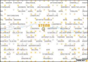
Steina (Bayern, Germany)Steina is a town in the Bayern region of Germany. An overview map of the region around Steina is displayed below.
regional and 3d topo map of Steina, Germany ::
Steina airports ::
The nearest airport is SZG - Salzburg, located 69.5 km south of Steina.
Other airports nearby include LNZ - Linz (Horsching) (85.6 km east), MUC - Munich Munchen (95.1 km west), FEL - Fuerstenfeldbruck Furstenfeldbruck (135.5 km west), OBF - Oberpfaffenhofen (137.6 km west), Nearby towns ::
Landerham (0.0km north) //
Spöck (0.0km north) //
Gries (1.9km north) //
Schwaibach (1.9km north) //
Doblham (1.2km west) //
Oberhitzling (1.9km south) //
Höll (1.9km south) //
Asenham (1.9km south) //
Leithen (2.2km north east) //
Bleichenbach (2.2km north east) //
Kainerding (2.5km east) //
Oberndorf (2.5km east) //
Untertattenbach (3.7km north) //
Loderham (2.5km west) //
Lengsham (2.5km west) //
Linding (3.7km south) //
Edmühle (3.1km north east) //
Aunham (3.9km north) //
Sturzholz (3.1km south east) //
Mühlham (3.9km north) //
Nindorf (3.9km north) //
Unterhitzling (3.9km south) //
Hoisching (3.9km south) //
Kauflanden (3.1km south west) //
Unter-Reitzing (3.9km south) //
Pelkering (3.9km south) //
Birnbach (4.4km north east) //
Hirschbach (4.4km north west) //
Holzhäuser (4.4km south east) //
[all distances 'as the bird flies' and approximate] 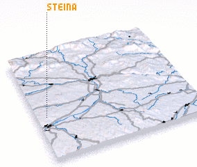 Places with similar names to Steina, Germany ::
Disclaimer :: Information on this page comes without warranty of any kind |
||
|
Where is Steina? Elevation and coordinates ::
Latitude (lat): 48°25'0"N Longitude (lon): 13°4'0"E
Elevation (approx.): 402m (map arrows pan, magnifying glasses zoom) |
||
|
Visiting Steina? Hotel/Accommodation ::
Book a hotel in Steina Travel Guide ::
Buy a travel guide for Germany rental cars ::
car rental offers GPS waypoint ::
download a GPX waypoint (PoI) of Steina for your GPS receiver
|
||