|
search place name
|
||
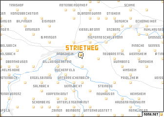
Strietweg (Baden-Württemberg, Germany)Strietweg is a town in the Baden-Württemberg region of Germany. An overview map of the region around Strietweg is displayed below.
regional and 3d topo map of Strietweg, Germany ::
Strietweg airports ::
The nearest airport is ZCC - Baden-baden Baden Oos, located 41.4 km west of Strietweg.
Other airports nearby include STR - Stuttgart (41.9 km south east), ZQC - Speyer (51.0 km north west), MHG - Mannheim City (67.5 km north), SXB - Strassbourg Entzheim (89.9 km south west), Nearby towns ::
Würm (1.9km south) //
Buckenberg (1.9km north) //
Pforzheim (2.4km west) //
Hagenschieß (2.4km east) //
Alter Göbricherweg (3.9km north) //
Eutingen (3.9km north) //
Huchenfeld (4.4km south west) //
Hohenwart (5.6km south) //
Unterreichenbach (5.7km south) //
Dillweißenstein (4.1km south west) //
Kieselbronn (5.7km north) //
Niefern-Öschelbronn (5.2km north east) //
Niefern (5.2km north east) //
Brötzingen (4.9km west) //
Neubärental (4.9km east) //
Dennjächt (7.5km south) //
Schellbronn (7.5km south) //
Grunbach (6.7km south west) //
Büchenbronn (6.1km south west) //
Ispringen (6.1km north west) //
Hamberg (8.3km south east) //
Steinegg (8.3km south east) //
Tiefenbronn (7.4km south east) //
Enzberg (7.4km north east) //
Eisingen (8.9km north west) //
[all distances 'as the bird flies' and approximate]  Places with similar names to Strietweg, Germany ::
// Strettweg (AT)
Disclaimer :: Information on this page comes without warranty of any kind |
||
|
Where is Strietweg? Elevation and coordinates ::
Latitude (lat): 48°53'0"N Longitude (lon): 8°44'0"E
Elevation (approx.): 374m (map arrows pan, magnifying glasses zoom) |
||
|
Visiting Strietweg? Hotel/Accommodation ::
Book a hotel in Strietweg Travel Guide ::
Buy a travel guide for Germany rental cars ::
car rental offers GPS waypoint ::
download a GPX waypoint (PoI) of Strietweg for your GPS receiver
|
||