|
search place name
|
||
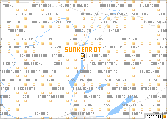
Sunkenrot (Bayern, Germany)Sunkenrot is a town in the Bayern region of Germany. An overview map of the region around Sunkenrot is displayed below.
regional and 3d topo map of Sunkenrot, Germany ::
Sunkenrot airports ::
The nearest airport is MUC - Munich Munchen, located 51.5 km north west of Sunkenrot.
Other airports nearby include SZG - Salzburg (65.6 km east), OBF - Oberpfaffenhofen (67.1 km west), FEL - Fuerstenfeldbruck Furstenfeldbruck (72.1 km west), INN - Innsbruck (100.0 km south west), Nearby towns ::
Untermühle (0.0km north) //
Holzhausen (1.2km east) //
Weng (1.9km north) //
Wechselberg (1.9km north) //
Eglham (1.9km south) //
Unterwöhrn (1.2km west) //
Haid (2.2km north east) //
Goßmaning (2.2km north east) //
Vogtareuth (2.2km south east) //
Winkl (2.2km south east) //
Kobel (2.2km south west) //
Viehhausen (2.5km east) //
Katzbach (3.7km north) //
Weikering (3.7km south) //
Feldkirchen (2.5km west) //
Schmiding (3.1km north east) //
Kornau (3.1km north east) //
Kolbing (3.1km north east) //
Wörlham (3.1km north east) //
Griesstätt (3.9km north) //
Zainach (3.9km north) //
Berg (3.9km north) //
Tödtenberg (3.9km south) //
Rott am Inn (3.1km north west) //
Lengdorf (3.1km north west) //
Dobl (3.1km north west) //
Geharting (3.1km south west) //
Oberwöhrn (3.1km south west) //
Raming (4.5km north east) //
[all distances 'as the bird flies' and approximate]  Places with similar names to Sunkenrot, Germany ::
// Sönnkenort (DE)
// Zinkenried (DE)
Disclaimer :: Information on this page comes without warranty of any kind |
||
|
Where is Sunkenrot? Elevation and coordinates ::
Latitude (lat): 47°58'0"N Longitude (lon): 12°10'0"E
Elevation (approx.): 462m (map arrows pan, magnifying glasses zoom) |
||
|
Visiting Sunkenrot? Hotel/Accommodation ::
Book a hotel in Sunkenrot Travel Guide ::
Buy a travel guide for Germany rental cars ::
car rental offers GPS waypoint ::
download a GPX waypoint (PoI) of Sunkenrot for your GPS receiver
|
||