|
search place name
|
||
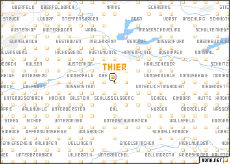
Thier (Nordrhein-Westfalen, Germany)Thier is a town in the Nordrhein-Westfalen region of Germany. An overview map of the region around Thier is displayed below.
regional and 3d topo map of Thier, Germany ::
Thier airports ::
The nearest airport is CGN - Cologne Koln Bonn, located 28.9 km south west of Thier.
Other airports nearby include ESS - Essen Mulheim (46.5 km north west), DUS - Duesseldorf Dusseldorf (47.8 km north west), DTM - Dortmund (51.3 km north), ZCA - Arnsberg Menden (58.0 km north east), Nearby towns ::
Niederfloßbach (0.0km north) //
Ballsiefen (1.9km south) //
Klespe (1.2km east) //
Ahe (1.2km west) //
Oberweinbach (1.9km north) //
Roderwiese (2.2km south east) //
Unter Büschem (2.2km south east) //
Buchholz (2.2km south east) //
Ober Büschem (2.2km south east) //
Peffekoven (2.2km south west) //
Münte (2.2km north east) //
Ritzenhaufe (2.2km north west) //
Schlüsselsberg (3.7km south) //
Kapellensüng (3.7km south) //
Heid (2.3km west) //
Hof (2.3km west) //
Unterschwarzen (2.3km west) //
Wipperhof (3.7km north) //
Finkelnburg (3.7km north) //
Neye (3.7km north) //
Breun (3.0km south east) //
Hartegasse (3.9km south) //
Sassenbach (3.0km north east) //
Niedergaul (3.0km north east) //
Gerhardsfeld (3.0km south west) //
Jörsensmühle (3.0km south west) //
Dahl (3.0km south west) //
Grüterich (3.0km north west) //
Wüstemünte (3.9km north) //
[all distances 'as the bird flies' and approximate]  Places with similar names to Thier, Germany ::
Disclaimer :: Information on this page comes without warranty of any kind |
||
|
Where is Thier? Elevation and coordinates ::
Latitude (lat): 51°5'0"N Longitude (lon): 7°22'0"E
Elevation (approx.): 258m (map arrows pan, magnifying glasses zoom) |
||
|
Visiting Thier? Hotel/Accommodation ::
Book a hotel in Thier Travel Guide ::
Buy a travel guide for Germany rental cars ::
car rental offers GPS waypoint ::
download a GPX waypoint (PoI) of Thier for your GPS receiver
|
||