|
search place name
|
||
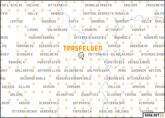
Trasfelden (Bayern, Germany)Trasfelden is a town in the Bayern region of Germany. An overview map of the region around Trasfelden is displayed below.
regional and 3d topo map of Trasfelden, Germany ::
Trasfelden airports ::
The nearest airport is LNZ - Linz (Horsching), located 80.5 km south east of Trasfelden.
Other airports nearby include SZG - Salzburg (108.6 km south), MUC - Munich Munchen (126.4 km west), PRG - Prague Ruzyne (164.4 km north), KLV - Karlovy Vary (167.2 km north), Nearby towns ::
Lanzendorf (0.0km north) //
Fahrnham (1.9km south) //
Niederham (1.9km south) //
Anschiessing (1.9km south) //
Hof (1.9km south) //
Eppendorf (1.2km east) //
Gehersberg (1.2km west) //
Tresdorf (1.2km west) //
Göttersberg (1.2km west) //
Rappenhof (1.2km east) //
Loizersdorf (1.9km north) //
Witzingerreut (1.9km north) //
Enzersdorf (2.2km south east) //
Pretz (2.2km south west) //
Siebenhasen (2.2km south west) //
Roitham (2.2km south west) //
Witzmannsberg (2.2km south east) //
Trautmannsdorf (2.2km north west) //
Hörmannsdorf (2.2km north west) //
Waltendorf (2.2km north east) //
Kothingrub (2.2km north east) //
Hohenwart (2.2km north west) //
Lueg (2.2km north east) //
Tittling (3.7km south) //
Stallham (3.7km south) //
Neppersdorf (3.7km south) //
Rettenbach (2.4km east) //
Gatzerreut (2.4km east) //
Hötzendorf (2.4km west) //
[all distances 'as the bird flies' and approximate]  Places with similar names to Trasfelden, Germany :: Disclaimer :: Information on this page comes without warranty of any kind |
||
|
Where is Trasfelden? Elevation and coordinates ::
Latitude (lat): 48°44'0"N Longitude (lon): 13°24'0"E
Elevation (approx.): 458m (map arrows pan, magnifying glasses zoom) |
||
|
Visiting Trasfelden? Hotel/Accommodation ::
Book a hotel in Trasfelden Travel Guide ::
Buy a travel guide for Germany rental cars ::
car rental offers GPS waypoint ::
download a GPX waypoint (PoI) of Trasfelden for your GPS receiver
|
||