|
search place name
|
||
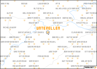
Unterellen (Thüringen, Germany)Unterellen is a town in the Thüringen region of Germany. An overview map of the region around Unterellen is displayed below.
regional and 3d topo map of Unterellen, Germany ::
Unterellen airports ::
The nearest airport is ERF - Erfurt, located 56.8 km east of Unterellen.
Other airports nearby include KSF - Kassel Calden (73.0 km north west), ZNF - Hanau Aaf (122.3 km south west), PAD - Paderborn Lippstadt (129.0 km north west), HOQ - Hof Plauen (142.3 km south east), Nearby towns ::
Dietrichsberg (1.9km south) //
Lauchröden (2.2km north east) //
Lutzberg (2.3km west) //
Wünschensuhl (3.7km south) //
Oberellen (3.0km south east) //
Fernbreitenbach (3.9km south) //
Göringen (4.4km north east) //
Wartha (4.0km north east) //
Herda (4.0km south west) //
Herleshausen (5.7km north) //
Baueshof (6.0km south east) //
Neustädt (5.1km north west) //
Sallmannshausen (5.1km north west) //
Wommen (6.0km north west) //
Hausbreitenbach (5.1km south west) //
Archfeld (7.4km north) //
Frauenborn (7.4km north) //
Josthof (7.5km south) //
Berka (5.0km west) //
Marksuhl (6.6km south east) //
Horschlitt (6.6km south west) //
Gospenroda (6.6km south west) //
Nesselröden (6.6km north west) //
Breitzbach (6.6km north west) //
Willershausen (7.8km north) //
Markershausen (7.8km north) //
Neuenhof (6.0km north east) //
Rienau (6.0km south west) //
Auenheim (6.0km south west) //
[all distances 'as the bird flies' and approximate]  Places with similar names to Unterellen, Germany ::
// Unterallen (DE)
// Unter Illnau (CH)
Disclaimer :: Information on this page comes without warranty of any kind |
||
|
Where is Unterellen? Elevation and coordinates ::
Latitude (lat): 50°58'0"N Longitude (lon): 10°9'0"E
Elevation (approx.): 248m (map arrows pan, magnifying glasses zoom) |
||
|
Visiting Unterellen? Hotel/Accommodation ::
Book a hotel in Unterellen Travel Guide ::
Buy a travel guide for Germany rental cars ::
car rental offers GPS waypoint ::
download a GPX waypoint (PoI) of Unterellen for your GPS receiver
|
||