|
search place name
|
||
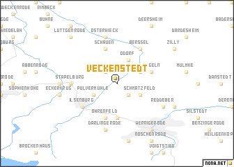
Veckenstedt (Sachsen-Anhalt, Germany)Veckenstedt is a town in the Sachsen-Anhalt region of Germany. An overview map of the region around Veckenstedt is displayed below.
regional and 3d topo map of Veckenstedt, Germany ::
Veckenstedt airports ::
The nearest airport is BWE - Braunschweig Wolfsburg, located 48.2 km north of Veckenstedt.
Other airports nearby include ZCN - Celle (91.0 km north west), HAJ - Hannover (95.1 km north west), ERF - Erfurt (103.6 km south), KSF - Kassel Calden (108.6 km south west), Nearby towns ::
Schauenteichen (2.2km north west) //
Neue Turmwarte (2.2km south east) //
Pulvermühle (2.9km south west) //
Odorf (3.9km north) //
Wasserleben (2.9km north east) //
Schmatzfeld (2.9km south east) //
Altenrode (5.6km south) //
Öhrenfeld (5.7km south) //
Drübeck (5.7km south) //
Schauen (5.7km north) //
Langeln (3.9km north east) //
Ilsenburg (5.1km south west) //
Berßel (6.0km north) //
Stapelburg (4.6km west) //
Darlingerode (7.5km south) //
Osterwieck (7.5km north) //
Reddeber (5.9km south east) //
Wernigerode (8.2km south east) //
Lüttgenrode (8.7km north west) //
Stötterlingen (8.7km north west) //
[all distances 'as the bird flies' and approximate]  Places with similar names to Veckenstedt, Germany :: Disclaimer :: Information on this page comes without warranty of any kind |
||
|
Where is Veckenstedt? Elevation and coordinates ::
Latitude (lat): 51°54'0"N Longitude (lon): 10°44'0"E
Elevation (approx.): 181m (map arrows pan, magnifying glasses zoom) |
||
|
Visiting Veckenstedt? Hotel/Accommodation ::
Book a hotel in Veckenstedt Travel Guide ::
Buy a travel guide for Germany rental cars ::
car rental offers GPS waypoint ::
download a GPX waypoint (PoI) of Veckenstedt for your GPS receiver
|
||