|
search place name
|
||
Wilhelmshöhe (Nordrhein-Westfalen, Germany)Wilhelmshöhe is a town in the Nordrhein-Westfalen region of Germany. An overview map of the region around Wilhelmshöhe is displayed below.
regional and 3d topo map of Wilhelmshöhe, Germany ::

Wilhelmshöhe airports ::
The nearest airport is DTM - Dortmund, located 19.5 km east of Wilhelmshöhe.
Other airports nearby include ESS - Essen Mulheim (29.6 km west), ZCA - Arnsberg Menden (39.4 km east), DUS - Duesseldorf Dusseldorf (45.9 km south west), MGL - Moenchengladbach Monchengladbach (65.1 km south west), Nearby towns ::
Harpenerweg (1.2km west) //
Holte (1.2km west) //
Lütgendortmund (1.2km east) //
Somborn (1.2km east) //
Merklinde (1.9km north) //
Brandheide (1.9km north) //
Siebenplaneten (2.2km south east) //
Grabeloh (3.7km south) //
Kolonie Borussia (2.3km east) //
Erindorf (3.9km north) //
Langendreer (3.9km south) //
Werne (3.0km south west) //
Frohlinde (3.9km north) //
Düren (3.9km south) //
Hangeney (3.0km north east) //
Dorney (3.0km south east) //
Ümmingen (4.4km south west) //
Kaltehardt (4.4km south west) //
Mittelfeld (4.4km north west) //
Obercastrop (4.4km north west) //
Westerberg (4.4km south west) //
Westerfilde (4.4km north east) //
Kirchlinde (4.4km north east) //
Stockum (4.4km south east) //
Sonnenschein (5.6km south) //
Ecksee (3.5km west) //
Oespel (3.5km east) //
Papenholz (5.7km south) //
Castrop-Rauxel (5.7km north) //
[all distances 'as the bird flies' and approximate] 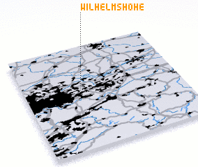 Places with similar names to Wilhelmshöhe, Germany ::
// Wilhelmshöhe (AT)
// Wilhelmshöhe (DE)
// Wilhelmshöhe (DE)
// Wilhelmshöhe (DE)
// Wilhelmshöhe (DE)
// Wilhelmshöhe (DE)
// Wilhelmshöhe (DE)
// Wilhelmshöhe (DE)
// Wilhelmshöhe (DE)
// Wilhelmshöhe (DE)
Disclaimer :: Information on this page comes without warranty of any kind |
||
|
Where is Wilhelmshöhe? Elevation and coordinates ::
Latitude (lat): 51°30'0"N Longitude (lon): 7°20'0"E
Elevation (approx.): 112m (map arrows pan, magnifying glasses zoom) |
||
|
Visiting Wilhelmshöhe? Hotel/Accommodation ::
Book a hotel in Wilhelmshöhe Travel Guide ::
Buy a travel guide for Germany rental cars ::
car rental offers GPS waypoint ::
download a GPX waypoint (PoI) of Wilhelmshöhe for your GPS receiver
|
||