|
search place name
|
||
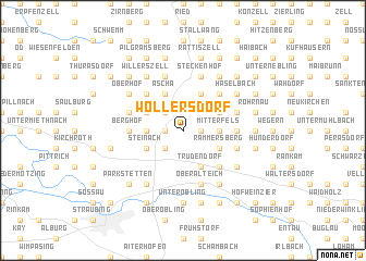
Wollersdorf (Bayern, Germany)Wollersdorf is a town in the Bayern region of Germany. An overview map of the region around Wollersdorf is displayed below.
regional and 3d topo map of Wollersdorf, Germany ::
Wollersdorf airports ::
The nearest airport is MUC - Munich Munchen, located 93.2 km south west of Wollersdorf.
Other airports nearby include NUE - Nuernberg Nurnberg (129.6 km north west), FEL - Fuerstenfeldbruck Furstenfeldbruck (132.6 km south west), SZG - Salzburg (133.1 km south), BYU - Bayreuth (134.9 km north west), Nearby towns ::
Weingarten (1.2km east) //
Scheibelsgrub (1.2km east) //
Wolferszell (1.2km west) //
Gschwendt (2.2km north west) //
Au (2.2km north west) //
Agendorf (2.2km south west) //
Mitterfels (2.4km east) //
Hinterbuchberg (2.4km east) //
Bärnzell (2.4km west) //
Schwarzendachsberg (3.1km north east) //
Rogendorf (3.1km north east) //
Willersberg (3.1km north west) //
Kienberg (3.1km north west) //
Oberniedersteinach (3.1km north west) //
Rammersberg (3.1km south east) //
Steinach (3.1km south west) //
Zachersdorf (3.9km north) //
Ascha (3.9km north) //
Trudendorf (3.9km south) //
Thurasdorf (4.4km north east) //
Herrnberg (4.4km north west) //
Niedermenach (4.4km south east) //
Vorderbuchberg (3.7km east) //
Berghof (3.7km west) //
Felling (4.1km north east) //
Hagnzell (4.1km north west) //
Hoch (4.1km south east) //
Lintach (4.1km south east) //
Grosslintach (4.1km south east) //
[all distances 'as the bird flies' and approximate] 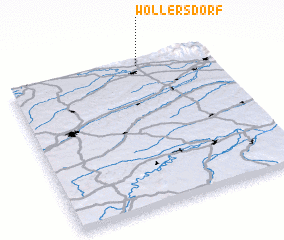 Places with similar names to Wollersdorf, Germany ::
// Wielersdorf (AT)
// Willersdorf (AT)
// Willersdorf (AT)
// Willersdorf (AT)
// Willersdorf (AT)
// Willersdorf (AT)
// Willersdorf (AT)
// Wöllersdorf (AT)
// Wöllersdorf (AT)
// Wullersdorf (AT)
Disclaimer :: Information on this page comes without warranty of any kind |
||
|
Where is Wollersdorf? Elevation and coordinates ::
Latitude (lat): 48°58'0"N Longitude (lon): 12°39'0"E
Elevation (approx.): 365m (map arrows pan, magnifying glasses zoom) |
||
|
Visiting Wollersdorf? Hotel/Accommodation ::
Book a hotel in Wollersdorf Travel Guide ::
Buy a travel guide for Germany rental cars ::
car rental offers GPS waypoint ::
download a GPX waypoint (PoI) of Wollersdorf for your GPS receiver
|
||