|
search place name
|
||
Ziegenrück (Thüringen, Germany)Ziegenrück is a town in the Thüringen region of Germany. An overview map of the region around Ziegenrück is displayed below.
regional and 3d topo map of Ziegenrück, Germany ::

Ziegenrück airports ::
The nearest airport is HOQ - Hof Plauen, located 39.3 km south of Ziegenrück.
Other airports nearby include ERF - Erfurt (63.3 km north west), BYU - Bayreuth (70.3 km south), AOC - Altenburg Nobitz (72.8 km north east), LEJ - Leipzig Halle (99.8 km north east), Nearby towns ::
Paska (1.2km west) //
Ludwigshof (1.9km south) //
Külmla (2.4km east) //
Keila (3.9km north) //
Bahren (3.9km north) //
Moxa (3.9km north) //
Posen (4.4km north east) //
Großkamsdorf (4.4km north west) //
Eßbach (4.4km south east) //
Walsburg (4.4km south east) //
Peuschen (5.6km north) //
Schöndorf (3.5km east) //
Liebengrün (5.6km south) //
Liebschütz (5.6km south) //
Bucha (4.0km north east) //
Tausa (4.0km north east) //
Laskau (5.7km north) //
Grobengereuth (5.7km north) //
Erkmannsdorf (4.0km south east) //
Altenbeuthen (4.0km south west) //
Daumitsch (6.0km north east) //
Dörflas (5.1km south east) //
Gertewitz (7.4km north) //
Gössitz (4.7km west) //
Weisbach (6.6km south west) //
Bodelwitz (7.8km north) //
Schmorda (6.0km north west) //
Neuenbeuthen (6.0km south west) //
Neunbeuthen (6.0km south west) //
[all distances 'as the bird flies' and approximate] 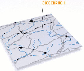 Places with similar names to Ziegenrück, Germany :: Disclaimer :: Information on this page comes without warranty of any kind |
||
|
Where is Ziegenrück? Elevation and coordinates ::
Latitude (lat): 50°37'0"N Longitude (lon): 11°39'0"E
Elevation (approx.): 335m (map arrows pan, magnifying glasses zoom) |
||
|
Visiting Ziegenrück? Hotel/Accommodation ::
Book a hotel in Ziegenrück Travel Guide ::
Buy a travel guide for Germany rental cars ::
car rental offers GPS waypoint ::
download a GPX waypoint (PoI) of Ziegenrück for your GPS receiver
|
||