|
search place name
|
||
Zinsershütten (Rheinland-Pfalz, Germany)Zinsershütten is a town in the Rheinland-Pfalz region of Germany. An overview map of the region around Zinsershütten is displayed below.
regional and 3d topo map of Zinsershütten, Germany ::

Zinsershütten airports ::
The nearest airport is ZQF - Trier Fohren, located 29.6 km north west of Zinsershütten.
Other airports nearby include HHN - Frankfurt Hahn (37.1 km north east), SPM - Spangdahlem Ab (43.5 km north west), RMS - Ramstein Ab (47.4 km south east), SCN - Saarbruecken Saarbrucken (48.7 km south), Nearby towns ::
Schmelz (2.2km south west) //
Neuhütten (2.2km south west) //
Züsch (2.4km west) //
Muhl (3.9km north) //
Schwarzenbach (5.7km south) //
Waldbach (5.7km south) //
Eisen (5.7km south) //
Damflos (4.0km north west) //
Achtelsbach (5.2km south east) //
Otzenhausen (6.1km south west) //
Börfink (5.2km north east) //
Thiergarten (5.2km north west) //
Obersötern (6.1km south east) //
Abentheuer (4.8km east) //
Mariahütte (6.6km south west) //
Sötern (6.6km south east) //
Meckenbach (6.1km south east) //
Dhronecken (8.2km north west) //
Malborn (8.2km north west) //
Thranenweier (7.3km north east) //
[all distances 'as the bird flies' and approximate] 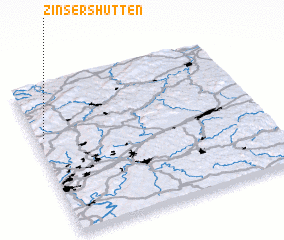 Places with similar names to Zinsershütten, Germany :: Disclaimer :: Information on this page comes without warranty of any kind |
||
|
Where is Zinsershütten? Elevation and coordinates ::
Latitude (lat): 49°39'0"N Longitude (lon): 7°2'0"E
Elevation (approx.): 597m (map arrows pan, magnifying glasses zoom) |
||
|
Visiting Zinsershütten? Hotel/Accommodation ::
Book a hotel in Zinsershütten Travel Guide ::
Buy a travel guide for Germany rental cars ::
car rental offers GPS waypoint ::
download a GPX waypoint (PoI) of Zinsershütten for your GPS receiver
|
||