|
search place name
|
||
Zumroda (Thüringen, Germany)Zumroda is a town in the Thüringen region of Germany. An overview map of the region around Zumroda is displayed below.
regional and 3d topo map of Zumroda, Germany ::

Zumroda airports ::
The nearest airport is AOC - Altenburg Nobitz, located 9.1 km north of Zumroda.
Other airports nearby include LEJ - Leipzig Halle (61.9 km north), HOQ - Hof Plauen (81.9 km south west), KLV - Karlovy Vary (82.9 km south), DRS - Dresden (92.6 km east), Nearby towns ::
Pfarrsdorf (1.2km west) //
Harthau (1.2km east) //
Runsdorf (1.2km west) //
Kleinmecka (1.9km north) //
Tettau (1.9km south) //
Oberwiera (1.9km south) //
Großmecka (1.9km north) //
Wünschendorf (1.9km south) //
Gieba (2.2km north west) //
Oberdorf (2.2km south east) //
Tautenhain (2.2km north east) //
Gösdorf (2.2km north east) //
Schönberg (3.7km south) //
Naundorf (2.3km west) //
Goldschau (2.3km west) //
Pfaffroda (3.9km south) //
Köthel (3.9km south) //
Breitenbach (3.9km south) //
Podelwitz (3.0km north west) //
Zschaiga (3.9km north) //
Mockzig (3.9km north) //
Ehrenhain (3.9km north) //
Oberarnsdorf (3.9km north) //
Prisselberg (4.4km north west) //
Niederwiera (3.5km east) //
Dippelsdorf (5.6km north) //
Hauersdorf (5.6km north) //
Dittrich (5.7km south) //
Neukirchen (4.0km south east) //
[all distances 'as the bird flies' and approximate] 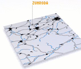 Places with similar names to Zumroda, Germany ::
Disclaimer :: Information on this page comes without warranty of any kind |
||
|
Where is Zumroda? Elevation and coordinates ::
Latitude (lat): 50°54'0"N Longitude (lon): 12°30'0"E
Elevation (approx.): 270m (map arrows pan, magnifying glasses zoom) |
||
|
Visiting Zumroda? Hotel/Accommodation ::
Book a hotel in Zumroda Travel Guide ::
Buy a travel guide for Germany rental cars ::
car rental offers GPS waypoint ::
download a GPX waypoint (PoI) of Zumroda for your GPS receiver
|
||