|
search place name
|
||
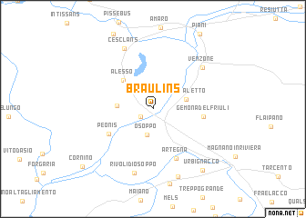
Braulins (Friuli-Venezia Giulia, Italy)Braulins is a town in the Friuli-Venezia Giulia region of Italy. An overview map of the region around Braulins is displayed below.
regional and 3d topo map of Braulins, Italy ::
nearby GPS traces from timatio ::
Braulins airports ::
The nearest airport is AVB - Aviano Ab (Pagliano E Gori), located 47.4 km south west of Braulins.
Other airports nearby include TRS - Ronchi De Legionari Ronchi Dei Legionari (59.2 km south east), TSF - Treviso (99.2 km south west), POW - Portoroz (99.3 km south east), KLU - Klagenfurt (Worthersee Intl) (103.8 km north east), Nearby towns ::
Trasaghis (1.4km south west) //
Osoppo (3.2km south) //
Ospedaletto (3.0km north east) //
Avasinis (3.1km west) //
Alesso (4.3km north west) //
Peonis (4.8km south west) //
Gemona del Friuli (4.4km east) //
Artegna (6.4km south) //
Venzone (6.6km north east) //
Cesclans (7.8km north) //
Rivoli di Osoppo (8.0km south) //
Buia (8.6km south) //
Urbignacco (8.6km south east) //
Cornino (9.3km south west) //
[all distances 'as the bird flies' and approximate]  Places with similar names to Braulins, Italy ::
// Bergholnes (NO)
// Brylińce (PL)
// Berlins (NZ)
// Bralance (HT)
// Bourlens (FR)
// Braillans (FR)
// Baarle-Nassau (NL)
Disclaimer :: Information on this page comes without warranty of any kind |
||
|
Where is Braulins? Elevation and coordinates ::
Latitude (lat): 46°17'15"N Longitude (lon): 13°5'15"E
Elevation (approx.): 294m (map arrows pan, magnifying glasses zoom) |
||
|
Visiting Braulins? Hotel/Accommodation ::
Book a hotel in Braulins Travel Guide ::
Buy a travel guide for Italy rental cars ::
car rental offers GPS waypoint ::
download a GPX waypoint (PoI) of Braulins for your GPS receiver
|
||