|
search place name
|
||
Brugneto (Italy)Brugneto is a town in Italy. An overview map of the region around Brugneto is displayed below.
regional and 3d topo map of Brugneto, Italy ::

Brugneto airports ::
The nearest airport is QPZ - Piacenza, located 36.6 km north east of Brugneto.
Other airports nearby include GOA - Genoa Genova Sestri (54.0 km south west), PMF - Parma (71.8 km east), LIN - Milan Linate (87.2 km north), VBS - Montichiari (111.2 km north east), Nearby towns ::
Fossoli (2.3km north east) //
Metteglia (3.7km north) //
Salsominore (3.7km south) //
Curletti (3.9km south) //
Marsaglia (4.5km north west) //
Cariseto (4.4km south west) //
La Costa (5.4km north west) //
Ballerini (6.2km north west) //
Solaro (5.3km east) //
Peli (7.5km north) //
Nicelli (5.6km east) //
Gambaro (6.8km south east) //
San Salvatore (8.4km north west) //
Orezzoli (8.4km south west) //
Pradovera (9.1km north east) //
[all distances 'as the bird flies' and approximate] 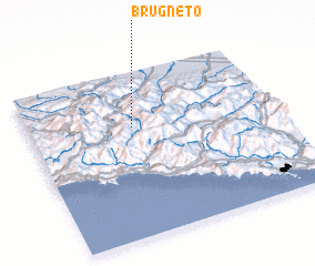 Places with similar names to Brugneto, Italy ::
// Burkuntē (ET)
// Bergante (PH)
// Borgunto (IT)
// Börgönd (HU)
// Bergüenda (ES)
// Burgunda (RU)
// Burgunda (RU)
// Bāraikānda (BD)
// Barai Kāndi (BD)
// Baraikāndi (BD)
Disclaimer :: Information on this page comes without warranty of any kind |
||
|
Where is Brugneto? Elevation and coordinates ::
Latitude (lat): 44°40'0"N Longitude (lon): 9°25'0"E
Elevation (approx.): 750m (map arrows pan, magnifying glasses zoom) |
||
|
Visiting Brugneto? Hotel/Accommodation ::
Book a hotel in Brugneto Travel Guide ::
Buy a travel guide for Italy rental cars ::
car rental offers GPS waypoint ::
download a GPX waypoint (PoI) of Brugneto for your GPS receiver
|
||