|
search place name
|
||
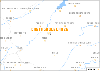
Castagnole Lanze (Italy)Castagnole Lanze is a town in Italy. An overview map of the region around Castagnole Lanze is displayed below.
regional and 3d topo map of Castagnole Lanze, Italy ::
Castagnole Lanze airports ::
The nearest airport is CUF - Levaldigi, located 46.3 km south west of Castagnole Lanze.
Other airports nearby include TRN - Torino (63.0 km north west), GOA - Genoa Genova Sestri (67.3 km south east), ALL - Albenga (77.7 km south), MXP - Milano Malpensa (108.5 km north east), Nearby towns ::
Neive (2.3km south west) //
Canove (4.5km north west) //
Costigliole dʼAsti (5.4km north east) //
Mango (7.5km south) //
[all distances 'as the bird flies' and approximate] 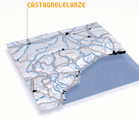 Places with similar names to Castagnole Lanze, Italy :: Disclaimer :: Information on this page comes without warranty of any kind |
||
|
Where is Castagnole Lanze? Elevation and coordinates ::
Latitude (lat): 44°45'0"N Longitude (lon): 8°8'0"E
Elevation (approx.): 210m (map arrows pan, magnifying glasses zoom) |
||
|
Visiting Castagnole Lanze? Hotel/Accommodation ::
Book a hotel in Castagnole Lanze Travel Guide ::
Buy a travel guide for Italy rental cars ::
car rental offers GPS waypoint ::
download a GPX waypoint (PoI) of Castagnole Lanze for your GPS receiver
|
||