|
search place name
|
||
Castel di Croce (Italy)Castel di Croce is a town in Italy. An overview map of the region around Castel di Croce is displayed below.
regional and 3d topo map of Castel di Croce, Italy ::

Castel di Croce airports ::
The nearest airport is PSR - Pescara, located 77.9 km south east of Castel di Croce.
Other airports nearby include PEG - Perugia (83.8 km west), RMI - Rimini (141.2 km north west), CIA - Rome Ciampino (147.1 km south west), QLT - Latina (162.4 km south), Nearby towns ::
Poggio Canoso (1.9km north) //
San Francesco (2.3km north east) //
Montadamo (3.9km south) //
Rotella (3.3km north east) //
Monsampietro (3.9km south) //
Rovetino (3.9km north) //
Polesia (4.6km south east) //
Capradosso (4.1km east) //
Venapiccola (5.7km south) //
Porchiano (5.5km south east) //
Venarotta (6.2km south west) //
Olibra Incinesca (7.4km south) //
Gimigliano (7.5km south) //
Ripaberarda (5.7km east) //
Montefalcone Appennino (6.9km north west) //
Montedinove (6.6km north east) //
Palmiano (6.6km south west) //
Casa Monti (8.5km north west) //
Olibra Incinante (9.2km south west) //
[all distances 'as the bird flies' and approximate] 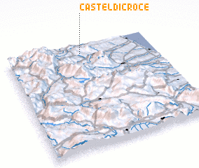 Places with similar names to Castel di Croce, Italy ::
// Castil de Carrias (ES)
Disclaimer :: Information on this page comes without warranty of any kind |
||
|
Where is Castel di Croce? Elevation and coordinates ::
Latitude (lat): 42°56'0"N Longitude (lon): 13°31'0"E
Elevation (approx.): 665m (map arrows pan, magnifying glasses zoom) |
||
|
Visiting Castel di Croce? Hotel/Accommodation ::
Book a hotel in Castel di Croce Travel Guide ::
Buy a travel guide for Italy rental cars ::
car rental offers GPS waypoint ::
download a GPX waypoint (PoI) of Castel di Croce for your GPS receiver
|
||