|
search place name
|
||
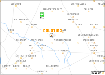
Galatina (Italy)Galatina is a town in Italy. An overview map of the region around Galatina is displayed below.
regional and 3d topo map of Galatina, Italy ::
Galatina airports ::
The nearest airport is LCC - Lecce, located 8.5 km north of Galatina.
Other airports nearby include BDS - Brindisi Casale (57.6 km north), TAR - Grottaglie (75.7 km north west), CRV - Crotone (159.9 km south west), BRI - Bari (160.6 km north west), Nearby towns ::
Noha (1.9km south) //
Soleto (3.4km north east) //
Sogliano Cavour (3.4km south east) //
Aradeo (4.7km south west) //
Gentiluomo (4.6km south west) //
Cutrofiano (6.2km south east) //
Collemeto (6.8km north west) //
Seclì (6.8km south west) //
Sternatia (7.9km north east) //
Datti (7.9km south west) //
Martignano (9.3km north east) //
Neviano (9.3km south west) //
[all distances 'as the bird flies' and approximate] 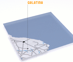 Places with similar names to Galatina, Italy ::
Disclaimer :: Information on this page comes without warranty of any kind |
||
|
Where is Galatina? Elevation and coordinates ::
Latitude (lat): 40°10'0"N Longitude (lon): 18°10'0"E
Elevation (approx.): 78m (map arrows pan, magnifying glasses zoom) |
||
|
Visiting Galatina? Hotel/Accommodation ::
Book a hotel in Galatina Travel Guide ::
Buy a travel guide for Italy rental cars ::
car rental offers GPS waypoint ::
download a GPX waypoint (PoI) of Galatina for your GPS receiver
|
||