|
search place name
|
||
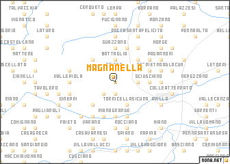
Magnanella (Italy)Magnanella is a town in Italy. An overview map of the region around Magnanella is displayed below.
regional and 3d topo map of Magnanella, Italy ::
Magnanella airports ::
The nearest airport is PSR - Pescara, located 53.0 km south east of Magnanella.
Other airports nearby include PEG - Perugia (102.3 km north west), CIA - Rome Ciampino (130.3 km south west), QLT - Latina (140.2 km south west), FCO - Rome Fiumicino (150.2 km south west), Nearby towns ::
Gesso (0.0km north) //
Castagneto (1.9km south) //
Pantaneto (1.9km south) //
Collecaruno (1.9km south) //
Roiano (1.9km north) //
Collicelli (1.9km north) //
Sciara (2.3km south west) //
Battaglia (3.7km north) //
Rupo (2.7km east) //
Torricella Sicura (3.9km south) //
Santo Stefano (4.6km south west) //
Gabiano (4.6km north west) //
Nocella (4.6km north east) //
Guazzano (5.6km north) //
Sciusciano (4.1km east) //
Piano Grande (5.6km south) //
Prognetto (5.7km south) //
Garrufo (5.7km north) //
Masseri (4.5km north east) //
Cavuccio (5.7km south) //
Borgonuovo (6.2km south west) //
Campli (5.5km north east) //
Campovalano (6.2km north east) //
Frondarola (7.4km south) //
Valle Piola (5.4km west) //
Poggio Valle (5.4km west) //
Colleminuccio (5.4km east) //
Cannelli (5.4km east) //
Le Ripe (7.4km north) //
[all distances 'as the bird flies' and approximate]  Places with similar names to Magnanella, Italy :: Disclaimer :: Information on this page comes without warranty of any kind |
||
|
Where is Magnanella? Elevation and coordinates ::
Latitude (lat): 42°41'0"N Longitude (lon): 13°38'0"E
Elevation (approx.): 691m (map arrows pan, magnifying glasses zoom) |
||
|
Visiting Magnanella? Hotel/Accommodation ::
Book a hotel in Magnanella Travel Guide ::
Buy a travel guide for Italy rental cars ::
car rental offers GPS waypoint ::
download a GPX waypoint (PoI) of Magnanella for your GPS receiver
|
||