|
search place name
|
||
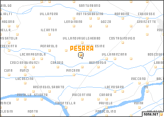
Pesara (Italy)Pesara is a town in Italy. An overview map of the region around Pesara is displayed below.
regional and 3d topo map of Pesara, Italy ::
Pesara airports ::
The nearest airport is QPA - Padova, located 45.9 km north east of Pesara.
Other airports nearby include BLQ - Bologna (59.4 km south west), VIC - Vicenza (62.3 km north), VRN - Villafranca (71.0 km north west), VCE - Venice Venezia Tessera (79.2 km north east), Nearby towns ::
Paolino (1.9km south) //
Fratta Polesine (2.3km north east) //
Villanova del Ghebbo (3.7km north) //
Bernarda (3.2km south east) //
San Bellino (3.2km north west) //
Pincara (3.9km south) //
Gognano (3.9km east) //
Ca Moro (4.3km south west) //
Villamarzana (5.2km east) //
Cavazzana (7.5km north) //
Lendinara (7.5km north) //
Perarolo (5.6km west) //
Dozza (8.4km north east) //
Il Canton (7.6km north west) //
La Crosara (9.1km south east) //
Argine del Sabato (9.1km south west) //
[all distances 'as the bird flies' and approximate]  Places with similar names to Pesara, Italy ::
Disclaimer :: Information on this page comes without warranty of any kind |
||
|
Where is Pesara? Elevation and coordinates ::
Latitude (lat): 45°1'0"N Longitude (lon): 11°37'0"E
Elevation (approx.): 3m (map arrows pan, magnifying glasses zoom) |
||
|
Visiting Pesara? Hotel/Accommodation ::
Book a hotel in Pesara Travel Guide ::
Buy a travel guide for Italy rental cars ::
car rental offers GPS waypoint ::
download a GPX waypoint (PoI) of Pesara for your GPS receiver
|
||