|
search place name
|
||
Polanesi (Italy)Polanesi is a town in Italy. An overview map of the region around Polanesi is displayed below.
regional and 3d topo map of Polanesi, Italy ::

Polanesi airports ::
The nearest airport is GOA - Genoa Genova Sestri, located 22.8 km west of Polanesi.
Other airports nearby include QPZ - Piacenza (77.5 km north east), ALL - Albenga (86.5 km south west), PMF - Parma (106.6 km north east), LIN - Milan Linate (120.5 km north), Nearby towns ::
Santʼ Apollinare (0.6km north) //
San Bartolomeo di Bussonengo (1.4km north) //
Ageno (1.3km north east) //
Lago (1.9km north) //
Sori (1.3km west) //
Pieve Alta (2.3km north west) //
Corsanego (2.5km north west) //
Recco (2.6km east) //
Pieve Ligure (2.6km west) //
Camogli (3.2km south east) //
Cotulo (3.2km south east) //
Molino Nuovo (3.3km north east) //
Corticella (3.2km north east) //
Collodari (3.3km east) //
San Bernardo (3.8km north west) //
Pannesi (5.6km north) //
San Rocco (4.7km south east) //
Vescina (4.2km east) //
Bogliasco (4.4km north west) //
Boschetto (4.6km south east) //
Salto (5.4km north east) //
Ruta (5.4km south east) //
Portofino Vetta (5.4km south east) //
San Martino di Noceto (5.0km east) //
San Ilario (5.2km north west) //
Bana (5.5km east) //
Uscio (6.8km north east) //
Traso (7.9km north) //
San Lorenzo della Costa (6.5km south east) //
[all distances 'as the bird flies' and approximate] 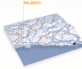 Places with similar names to Polanesi, Italy ::
Disclaimer :: Information on this page comes without warranty of any kind |
||
|
Where is Polanesi? Elevation and coordinates ::
Latitude (lat): 44°22'0"N Longitude (lon): 9°7'0"E
Elevation (approx.): 73m (map arrows pan, magnifying glasses zoom) |
||
|
Visiting Polanesi? Hotel/Accommodation ::
Book a hotel in Polanesi Travel Guide ::
Buy a travel guide for Italy rental cars ::
car rental offers GPS waypoint ::
download a GPX waypoint (PoI) of Polanesi for your GPS receiver
|
||