|
search place name
|
||
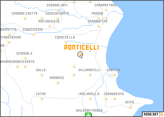
Ponticelli (Italy)Ponticelli is a town in Italy. An overview map of the region around Ponticelli is displayed below.
regional and 3d topo map of Ponticelli, Italy ::
Ponticelli airports ::
The nearest airport is CRV - Crotone, located 13.3 km south of Ponticelli.
Other airports nearby include SUF - Lamezia Terme (75.2 km west), LCC - Lecce (154.6 km north east), TAR - Grottaglie (158.2 km north), REG - Reggio Calabria (169.3 km south west), Nearby towns ::
Casa Margherita (2.3km north east) //
Giamiglione (2.3km south west) //
Villa Morelli (4.0km south) //
Apriglianello (4.0km south) //
Corazzello (4.7km north west) //
Papanice (7.0km south west) //
Casa Bucche (8.0km north) //
Crotone (6.8km south east) //
Rocca di Neto (9.4km north west) //
[all distances 'as the bird flies' and approximate]  Places with similar names to Ponticelli, Italy ::
// Ponticelli (IT)
// Ponticelli (IT)
// Ponticelli (IT)
// Ponticelli (IT)
// Pontezuela (CU)
// Ponticiella (ES)
// Puenteciella (ES)
// Pandisili (BF)
// Pontezuela (CO)
// Pontezuela (GT)
Disclaimer :: Information on this page comes without warranty of any kind |
||
|
Where is Ponticelli? Elevation and coordinates ::
Latitude (lat): 39°7'0"N Longitude (lon): 17°4'0"E
Elevation (approx.): 81m (map arrows pan, magnifying glasses zoom) |
||
|
Visiting Ponticelli? Hotel/Accommodation ::
Book a hotel in Ponticelli Travel Guide ::
Buy a travel guide for Italy rental cars ::
car rental offers GPS waypoint ::
download a GPX waypoint (PoI) of Ponticelli for your GPS receiver
|
||