|
search place name
|
||
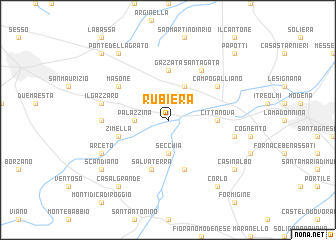
Rubiera (Italy)Rubiera is a town in Italy. An overview map of the region around Rubiera is displayed below.
regional and 3d topo map of Rubiera, Italy ::
Rubiera airports ::
The nearest airport is BLQ - Bologna, located 42.1 km east of Rubiera.
Other airports nearby include PMF - Parma (43.2 km north west), VRN - Villafranca (83.3 km north), QPZ - Piacenza (88.8 km west), VBS - Montichiari (93.6 km north), Nearby towns ::
Secchia (3.7km south) //
Palazzina (2.6km west) //
San Faustino (3.9km north) //
Cittanova (4.0km east) //
Gazzata (5.6km north) //
Salvaterra (5.7km south) //
Magreta (5.7km south) //
Zimella (4.4km south west) //
Campogalliano (5.4km north east) //
Masone (5.4km north west) //
SantʼAgata (6.2km north east) //
Marmirolo (5.3km west) //
Il Gazzaro (5.6km west) //
Casa Canevazzi (5.6km east) //
Arceto (6.4km south west) //
Scandiano (7.7km south west) //
Casinalbo (7.7km south east) //
Corlo (8.4km south east) //
Casalgrande (8.4km south west) //
Ponte dellʼAgrato (8.4km north west) //
Massenzatico (9.1km north west) //
Papotti (9.1km north east) //
[all distances 'as the bird flies' and approximate]  Places with similar names to Rubiera, Italy ::
Disclaimer :: Information on this page comes without warranty of any kind |
||
|
Where is Rubiera? Elevation and coordinates ::
Latitude (lat): 44°39'0"N Longitude (lon): 10°47'0"E
Elevation (approx.): 53m (map arrows pan, magnifying glasses zoom) |
||
|
Visiting Rubiera? Hotel/Accommodation ::
Book a hotel in Rubiera Travel Guide ::
Buy a travel guide for Italy rental cars ::
car rental offers GPS waypoint ::
download a GPX waypoint (PoI) of Rubiera for your GPS receiver
|
||