|
search place name
|
||
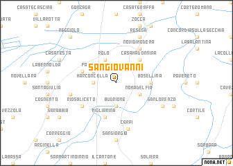
San Giovanni (Italy)San Giovanni is a town in Italy. An overview map of the region around San Giovanni is displayed below.
regional and 3d topo map of San Giovanni, Italy ::
San Giovanni airports ::
The nearest airport is PMF - Parma, located 45.2 km west of San Giovanni.
Other airports nearby include BLQ - Bologna (48.4 km south east), VRN - Villafranca (60.7 km north), VBS - Montichiari (76.9 km north west), QPZ - Piacenza (90.6 km west), Nearby towns ::
Budrione (3.7km south) //
Marconcella (2.6km west) //
Rolo (3.9km north) //
Nomadelfia (3.2km south east) //
Fabbrico (3.2km north west) //
Casa Madonnina (4.5km north east) //
Bosellina (3.9km east) //
Follona (4.4km north west) //
Migliarina (5.7km south) //
Novi di Modena (6.1km north east) //
Rio Saliceto (5.4km south west) //
Carpi (7.5km south) //
Ponte Vettigano (5.6km west) //
San Lorenzo (6.4km south east) //
Resega (7.9km north) //
Reggiolo (9.1km north west) //
[all distances 'as the bird flies' and approximate]  Places with similar names to San Giovanni, Italy ::
// San Giovanni (IT)
// San Giovanni (IT)
// San Giovanni (IT)
// San Giovanni (IT)
// San Giovanni (IT)
// San Giovanni (IT)
// San Giovanni (IT)
// San Giovanni (IT)
// San Giovanni (IT)
// San Giovanni (IT)
Disclaimer :: Information on this page comes without warranty of any kind |
||
|
Where is San Giovanni? Elevation and coordinates ::
Latitude (lat): 44°51'0"N Longitude (lon): 10°52'0"E
Elevation (approx.): 18m (map arrows pan, magnifying glasses zoom) |
||
|
Visiting San Giovanni? Hotel/Accommodation ::
Book a hotel in San Giovanni Travel Guide ::
Buy a travel guide for Italy rental cars ::
car rental offers GPS waypoint ::
download a GPX waypoint (PoI) of San Giovanni for your GPS receiver
|
||