|
search place name
|
||
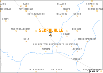
Serravalle (Italy)Serravalle is a town in Italy. An overview map of the region around Serravalle is displayed below.
regional and 3d topo map of Serravalle, Italy ::
Serravalle airports ::
The nearest airport is SAY - Siena Ampugnano, located 19.9 km north west of Serravalle.
Other airports nearby include GRS - Grosseto (55.5 km south west), FLR - Firenze (74.5 km north), PEG - Perugia (85.5 km east), PSA - Pisa (104.2 km north west), Nearby towns ::
Ponte dʼArbia (NaNkm north) //
Buonconvento (3.9km south) //
Villa Montesoli (4.6km south west) //
Moccia (4.1km east) //
Sovignano (4.5km north west) //
Cristena (4.5km north east) //
Bibbiano (5.7km south) //
Rosennano (7.9km north) //
Pieve a Salti (6.6km south east) //
Monteroni dʼArbia (8.4km north west) //
[all distances 'as the bird flies' and approximate]  Places with similar names to Serravalle, Italy ::
// Şǝrǝfli (AZ)
// Sarovlu (AZ)
// São Rafael (BR)
// São Rafael (BR)
// São Rafael (BR)
// São Rafael (BR)
// São Rafael (BR)
// São Rafael (BR)
// Sarvuela (BR)
// Sierraville (US)
Disclaimer :: Information on this page comes without warranty of any kind |
||
|
Where is Serravalle? Elevation and coordinates ::
Latitude (lat): 43°10'0"N Longitude (lon): 11°28'0"E
Elevation (approx.): 147m (map arrows pan, magnifying glasses zoom) |
||
|
Visiting Serravalle? Hotel/Accommodation ::
Book a hotel in Serravalle Travel Guide ::
Buy a travel guide for Italy rental cars ::
car rental offers GPS waypoint ::
download a GPX waypoint (PoI) of Serravalle for your GPS receiver
|
||