|
search place name
|
||
Jelendol (Cankova-Tišina, Slovenia)Jelendol is a town in the Cankova-Tišina region of Slovenia. An overview map of the region around Jelendol is displayed below.
regional and 3d topo map of Jelendol, Slovenia ::

Jelendol airports ::
The nearest airport is RJK - Rijeka, located 52.9 km south of Jelendol.
Other airports nearby include LJU - Ljubliana Ljubljana (65.6 km north), POW - Portoroz (92.4 km west), ZAG - Zagreb (101.9 km east), TRS - Ronchi De Legionari Ronchi Dei Legionari (101.9 km west), Nearby towns ::
Grčarske Ravne (1.8km south west) //
Grčarice (2.6km south) //
Rakitnica (3.0km north) //
Blate (3.4km north) //
Dolenja Vas (3.7km north) //
Prigorica (4.4km north) //
Lipovec (4.5km north) //
Gornje Ložine (3.6km north east) //
Zadolje (4.2km north west) //
Nemška Vas (5.1km north) //
Dolnje Ložine (4.0km north east) //
Nove Ložine (4.2km east) //
Makoše (5.7km north) //
GoričaVas (6.6km north) //
Slovenska Vas (4.9km east) //
Gotenica (7.1km south) //
Otavice (7.7km north) //
Koblarji (5.5km east) //
Stara Cerkev (5.5km east) //
Mlaka pri Kočevski Reki (7.7km south) //
Ribnica (7.8km north) //
Glažuta (6.3km west) //
Koče (9.2km south) //
(( Kuka Vas )) (9.0km north east) //
Vrbovec (8.4km north east) //
Dane (8.9km north west) //
Jurjevica (10.3km north west) //
[all distances 'as the bird flies' and approximate] 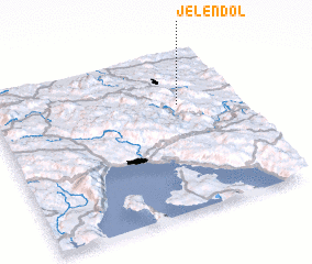 Places with similar names to Jelendol, Slovenia ::
Disclaimer :: Information on this page comes without warranty of any kind |
||
|
Where is Jelendol? Elevation and coordinates ::
Latitude (lat): 45°40'24"N Longitude (lon): 14°45'49"E
Elevation (approx.): 518m (map arrows pan, magnifying glasses zoom) |
||
|
Visiting Jelendol? Hotel/Accommodation ::
Book a hotel in Jelendol Travel Guide ::
Buy a travel guide for Slovenia rental cars ::
car rental offers GPS waypoint ::
download a GPX waypoint (PoI) of Jelendol for your GPS receiver
|
||