|
search place name
|
||
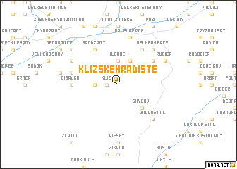
Klížske Hradište (Slovakia)Klížske Hradište is a town in Slovakia. An overview map of the region around Klížske Hradište is displayed below.
regional and 3d topo map of Klížske Hradište, Slovakia ::
Klížske Hradište airports ::
The nearest airport is PZY - Piestany, located 41.8 km west of Klížske Hradište.
Other airports nearby include SLD - Sliac (56.2 km east), BTS - Bratislava M R Stefanik (96.5 km south west), PRV - Prerov (120.9 km north west), OSR - Ostrava Mosnov (129.0 km north), Nearby towns ::
Klíž (1.2km west) //
Ješkova Ves (2.5km west) //
Hlboké (3.7km north) //
Andrašová (3.9km north) //
Skýcov (4.4km south east) //
Diel (5.2km north east) //
Brodzany (6.1km north west) //
Valacheje (6.1km north east) //
Šípok (6.1km north east) //
Cibajka (4.9km west) //
Janova Ves (5.2km west) //
Malé Uherce (7.5km north) //
Javor Štál (6.7km south east) //
Kolačno (6.7km north east) //
Veľké Uherce (6.7km north east) //
Turčianky (6.1km north west) //
Rudica (6.1km north east) //
Krásno (7.4km north west) //
[all distances 'as the bird flies' and approximate]  Places with similar names to Klížske Hradište, Slovakia :: Disclaimer :: Information on this page comes without warranty of any kind |
||
|
Where is Klížske Hradište? Elevation and coordinates ::
Latitude (lat): 48°33'0"N Longitude (lon): 18°23'0"E
Elevation (approx.): 325m (map arrows pan, magnifying glasses zoom) |
||
|
Visiting Klížske Hradište? Hotel/Accommodation ::
Book a hotel in Klížske Hradište Travel Guide ::
Buy a travel guide for Slovakia rental cars ::
car rental offers GPS waypoint ::
download a GPX waypoint (PoI) of Klížske Hradište for your GPS receiver
|
||