|
search place name
|
||
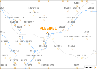
Plešivec (Slovakia)Plešivec is a town in Slovakia. An overview map of the region around Plešivec is displayed below.
regional and 3d topo map of Plešivec, Slovakia ::
Plešivec airports ::
The nearest airport is TAT - Poprad Tatry, located 59.4 km north of Plešivec.
Other airports nearby include KSC - Kosice (63.3 km east), SLD - Sliac (93.9 km west), DEB - Debrecen (148.8 km south east), BUD - Budapest Ferihegy (150.4 km south west), Nearby towns ::
Gemerská Horka (2.2km south west) //
Ardovo (2.2km south east) //
Bohúňvo (3.9km south) //
Tiba (3.9km south) //
Čoltovo (5.7km south) //
Vidová (4.1km north east) //
Pašková (5.7km north) //
Dlhá Ves (6.1km south east) //
Gombasek (5.2km east) //
Kunova Teplica (7.5km north) //
Meliata (6.2km south west) //
Nováčany (6.1km north west) //
Bretka (8.3km south west) //
Rozložná (8.3km north west) //
[all distances 'as the bird flies' and approximate]  Places with similar names to Plešivec, Slovakia ::
Disclaimer :: Information on this page comes without warranty of any kind |
||
|
Where is Plešivec? Elevation and coordinates ::
Latitude (lat): 48°33'0"N Longitude (lon): 20°24'0"E
Elevation (approx.): 212m (map arrows pan, magnifying glasses zoom) |
||
|
Visiting Plešivec? Hotel/Accommodation ::
Book a hotel in Plešivec Travel Guide ::
Buy a travel guide for Slovakia rental cars ::
car rental offers GPS waypoint ::
download a GPX waypoint (PoI) of Plešivec for your GPS receiver
|
||