|
search place name
|
||
Dehetné (Czech Republic)Dehetné is a town in Czech Republic. An overview map of the region around Dehetné is displayed below.
regional and 3d topo map of Dehetné, Czech Republic ::

Dehetné airports ::
The nearest airport is KLV - Karlovy Vary, located 64.2 km north of Dehetné.
Other airports nearby include BYU - Bayreuth (90.1 km north west), HOQ - Hof Plauen (98.0 km north west), PRG - Prague Ruzyne (119.3 km north east), NUE - Nuernberg Nurnberg (123.9 km west), Nearby towns ::
Borek (1.2km east) //
Sychrov (2.2km south east) //
Valcha (2.2km north east) //
Bernartice (2.4km east) //
Holubeč (3.9km south) //
Přes (3.0km south east) //
Čečín (3.9km south) //
Stráž (3.9km north) //
Jadruž (3.0km north west) //
Svržno (5.6km south) //
Dubec (3.6km west) //
Strachovice (3.6km east) //
Pavlíkov (4.1km south west) //
Nový Dvŭr (5.7km north) //
Doubravka (5.7km south) //
Olešná (4.0km north east) //
Malé Dvorce (4.0km north west) //
Třískolupy (4.0km north west) //
Souměř (5.7km north) //
Mírkovice (6.1km south east) //
Mělnice (5.2km south east) //
Bonětice (5.2km north east) //
Kundratice (5.2km north west) //
Rájov (4.8km west) //
Třemešné (4.8km west) //
Boreček (7.4km north) //
Vidice (5.1km east) //
Hostouň (7.5km south) //
Újezd Svatého Kříže (7.5km south) //
[all distances 'as the bird flies' and approximate] 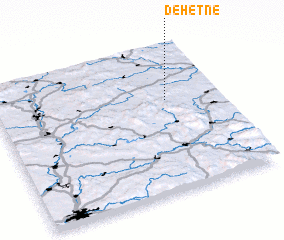 Places with similar names to Dehetné, Czech Republic ::
Disclaimer :: Information on this page comes without warranty of any kind |
||
|
Where is Dehetné? Elevation and coordinates ::
Latitude (lat): 49°38'0"N Longitude (lon): 12°46'0"E
Elevation (approx.): 463m (map arrows pan, magnifying glasses zoom) |
||
|
Visiting Dehetné? Hotel/Accommodation ::
Book a hotel in Dehetné Travel Guide ::
rental cars ::
car rental offers GPS waypoint ::
download a GPX waypoint (PoI) of Dehetné for your GPS receiver
|
||