|
search place name
|
||
Halseby (Vestsjælland, Denmark)Halseby is a town in the Vestsjælland region of Denmark. An overview map of the region around Halseby is displayed below.
regional and 3d topo map of Halseby, Denmark ::

Halseby airports ::
The nearest airport is ODE - Odense, located 56.8 km west of Halseby.
Other airports nearby include RKE - Copenhagen Roskilde (64.5 km north east), CPH - Copenhagen Kastrup (96.8 km east), SGD - Soenderborg Sonderborg (99.5 km south west), AAR - Aarhus (111.9 km north), Nearby towns ::
Svenstrup (2.1km north west) //
Frølunde (2.1km north west) //
Tjæreby (2.1km north east) //
Ormeslev (3.2km east) //
Halsskov (3.7km south west) //
Korsør (3.7km south west) //
Næsby Fed (4.9km north west) //
Strandlyst (5.9km north) //
Atterup (4.9km south east) //
Gryderup (4.9km south east) //
Vester Bøgebjerg (5.9km south) //
Lille Kongsmark (7.4km north) //
Vemmelev (4.6km north east) //
Forlev Stationsby (5.6km north east) //
Næsby ved Stranden (7.0km north east) //
Kelstrup (8.1km north east) //
[all distances 'as the bird flies' and approximate] 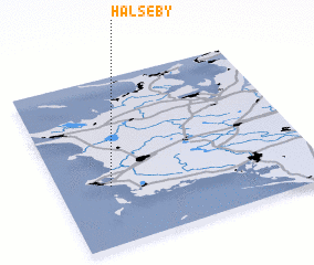 Places with similar names to Halseby, Denmark ::
Disclaimer :: Information on this page comes without warranty of any kind |
||
|
Where is Halseby? Elevation and coordinates ::
Latitude (lat): 55°21'0"N Longitude (lon): 11°12'0"E
(map arrows pan, magnifying glasses zoom) |
||
|
Visiting Halseby? Hotel/Accommodation ::
Book a hotel in Halseby Travel Guide ::
Buy a travel guide for Denmark rental cars ::
car rental offers GPS waypoint ::
download a GPX waypoint (PoI) of Halseby for your GPS receiver
|
||