|
search place name
|
||
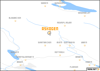
Åskogen (Norrbotten, Sweden)Åskogen is a town in the Norrbotten region of Sweden. An overview map of the region around Åskogen is displayed below.
regional and 3d topo map of Åskogen, Sweden ::
Åskogen airports ::
The nearest airport is LLA - Lulea Kallax, located 45.9 km south of Åskogen.
Other airports nearby include GEV - Gallivare (140.7 km north), SFT - Skelleftea (149.8 km south), KRN - Kiruna (220.2 km north), Nearby towns ::
Hundsjö (1.9km north) //
Svartbäcken (3.8km south) //
Inbyn (4.0km south) //
Nedre Flåsjön (4.3km north east) //
Notträsk (7.6km south) //
Skatamark (4.8km south east) //
[all distances 'as the bird flies' and approximate] 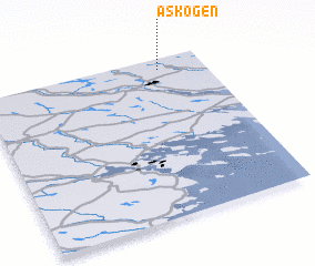 Places with similar names to Åskogen, Sweden :: Disclaimer :: Information on this page comes without warranty of any kind |
||
|
Where is Åskogen? Elevation and coordinates ::
Latitude (lat): 65°56'0"N Longitude (lon): 21°48'0"E
(map arrows pan, magnifying glasses zoom) |
||
|
Visiting Åskogen? Hotel/Accommodation ::
Book a hotel in Åskogen Travel Guide ::
Buy a travel guide for Sweden rental cars ::
car rental offers GPS waypoint ::
download a GPX waypoint (PoI) of Åskogen for your GPS receiver
|
||