|
search place name
|
||
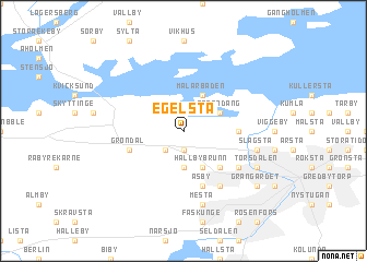
Egelsta (Södermanland, Sweden)Egelsta is a town in the Södermanland region of Sweden. An overview map of the region around Egelsta is displayed below.
regional and 3d topo map of Egelsta, Sweden ::
Egelsta airports ::
The nearest airport is VST - Vasteras, located 22.8 km north east of Egelsta.
Other airports nearby include NYO - Stockholm Skavsta (75.5 km south), ORB - Orebro (81.4 km west), BMA - Stockholm Bromma (86.9 km east), ARN - Stockholm Arlanda (88.9 km east), Nearby towns ::
Folkesta (1.9km south) //
Sövsta (2.1km south west) //
Hällby (3.7km south) //
Roxnäs (2.6km north east) //
Strandäng (2.6km north east) //
Nybybruk (2.6km north east) //
Mälarbaden (3.8km north) //
Eliseberg (3.8km south) //
Hällbybrunn (3.8km south) //
Flacksta (4.2km south east) //
Torshälla (2.8km east) //
Åsby (5.6km south) //
Gröndal (3.4km south west) //
Kolsta (5.9km south) //
Brottsta (4.7km south east) //
Slagsta (4.2km south east) //
Ärna (4.2km south east) //
Berga (7.5km south) //
Mesta (7.5km south) //
Närjeholme (5.3km south east) //
Torsdalen (5.3km south east) //
Grangärdet (6.7km south east) //
[all distances 'as the bird flies' and approximate] 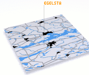 Places with similar names to Egelsta, Sweden ::
// Egelsta (SE)
Disclaimer :: Information on this page comes without warranty of any kind |
||
|
Where is Egelsta? Elevation and coordinates ::
Latitude (lat): 59°25'0"N Longitude (lon): 16°25'0"E
Elevation (approx.): 27m (map arrows pan, magnifying glasses zoom) |
||
|
Visiting Egelsta? Hotel/Accommodation ::
Book a hotel in Egelsta Travel Guide ::
Buy a travel guide for Sweden rental cars ::
car rental offers GPS waypoint ::
download a GPX waypoint (PoI) of Egelsta for your GPS receiver
|
||