|
search place name
|
||
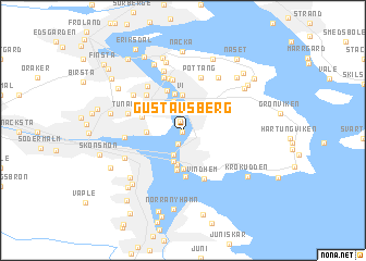
Gustavsberg (Västernorrland, Sweden)Gustavsberg is a town in the Västernorrland region of Sweden. An overview map of the region around Gustavsberg is displayed below.
regional and 3d topo map of Gustavsberg, Sweden ::
Gustavsberg airports ::
The nearest airport is SDL - Sundsvall Harnosand, located 14.3 km north of Gustavsberg.
Other airports nearby include HUV - Hudiksvall (72.7 km south), KRF - Kramfors Solleftea (74.4 km north), OER - Ornskoldsvik (137.8 km north east), GVX - Gavle (202.9 km south), Nearby towns ::
Lervik (0.1km south west) //
Strand (1.0km north) //
Karlsvik (1.4km south) //
Usland (2.5km north) //
Myrnäs (2.5km south) //
Alvik (3.0km north) //
Utvik (3.2km south) //
Ankarsvik (3.4km south) //
Vi (3.6km north) //
Korsta (1.8km west) //
Sandarna (3.9km south) //
Älva (3.8km north) //
Stenvik (4.0km south) //
Gustavshamn (4.2km north) //
Tunadal (2.5km north west) //
Viken (4.6km south) //
Näs (4.0km north west) //
Vindhem (4.9km south) //
Rökland (5.2km north) //
Alnö (5.4km north) //
Pottäng (5.5km north) //
Alnö (5.5km north) //
Nyvik (5.5km north) //
Huggsta (4.8km north) //
Tunaby (3.2km north west) //
Ortviken (2.8km west) //
Johannedal (4.4km north west) //
Båräng (6.2km north) //
Ås (5.7km north) //
[all distances 'as the bird flies' and approximate]  Places with similar names to Gustavsberg, Sweden ::
// Gustavsburg (DE)
// Gustavsberg (SE)
// Gustavsberg (SE)
// Gustavsberg (SE)
// Gustavsberg (SE)
// Gustavsberg (SE)
// Gustavsberg (SE)
Disclaimer :: Information on this page comes without warranty of any kind |
||
|
Where is Gustavsberg? Elevation and coordinates ::
Latitude (lat): 62°24'3"N Longitude (lon): 17°25'3"E
(map arrows pan, magnifying glasses zoom) |
||
|
Visiting Gustavsberg? Hotel/Accommodation ::
Book a hotel in Gustavsberg Travel Guide ::
Buy a travel guide for Sweden rental cars ::
car rental offers GPS waypoint ::
download a GPX waypoint (PoI) of Gustavsberg for your GPS receiver
|
||