|
search place name
|
||
Hallhult (Jönköping, Sweden)Hallhult is a town in the Jönköping region of Sweden. An overview map of the region around Hallhult is displayed below.
regional and 3d topo map of Hallhult, Sweden ::

Hallhult airports ::
The nearest airport is JKG - Joenkoeping Jonkoping, located 33.6 km north west of Hallhult.
Other airports nearby include HLF - Hultsfred (75.9 km east), VXO - Vaxjo Kronoberg (77.2 km south), KVB - Skovde (99.9 km north), LPI - Linkoeping Saab (109.8 km north east), Nearby towns ::
Spånarp (2.1km north east) //
Lunnestorp (3.7km north) //
Fredricksdal (2.0km east) //
Havrida (2.7km north east) //
Göstorp (2.7km north west) //
Älgaryd (2.7km south west) //
Ekefall (4.2km north east) //
Kansjö (4.2km north west) //
Berg (3.0km west) //
Svenstorp (5.6km north) //
Barkansjö (5.6km south) //
Gransäng (5.9km north) //
Topperyd (5.9km north) //
Långåsa (7.4km north) //
Floryd (4.0km west) //
Norra Hiarum (4.0km west) //
Rödja (7.5km north) //
Södra Hiarum (4.4km south west) //
Mållebo (7.7km north) //
Slätteryd (5.4km north west) //
Almesåkra (7.7km south) //
Axlarp (6.8km north west) //
Klappa (8.4km south west) //
[all distances 'as the bird flies' and approximate] 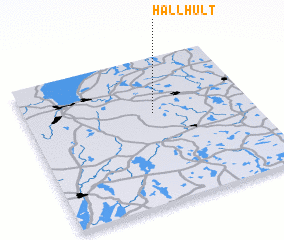 Places with similar names to Hallhult, Sweden ::
Disclaimer :: Information on this page comes without warranty of any kind |
||
|
Where is Hallhult? Elevation and coordinates ::
Latitude (lat): 57°37'0"N Longitude (lon): 14°34'0"E
Elevation (approx.): 343m (map arrows pan, magnifying glasses zoom) |
||
|
Visiting Hallhult? Hotel/Accommodation ::
Book a hotel in Hallhult Travel Guide ::
Buy a travel guide for Sweden rental cars ::
car rental offers GPS waypoint ::
download a GPX waypoint (PoI) of Hallhult for your GPS receiver
|
||