|
search place name
|
||
Järved (Västernorrland, Sweden)Järved is a town in the Västernorrland region of Sweden. An overview map of the region around Järved is displayed below.
regional and 3d topo map of Järved, Sweden ::

Järved airports ::
The nearest airport is OER - Ornskoldsvik, located 19.4 km north east of Järved.
Other airports nearby include KRF - Kramfors Solleftea (55.9 km south west), UME - Umea (95.5 km north east), SDL - Sundsvall Harnosand (106.3 km south west), LYC - Lycksele (142.9 km north), Nearby towns ::
Bonäset (0.0km north) //
Bodum (0.8km east) //
Vårby (1.9km south) //
Överön (3.8km north) //
Dekarsön (2.5km south east) //
Lugnvik (2.5km north west) //
Norrvåge (3.8km south) //
Nederön (4.1km north east) //
Skortsed (5.6km north) //
Sörvåge (5.6km south) //
Hörneberg (2.7km west) //
Arnäsvall (5.6km north) //
Lakasund (3.1km north east) //
Domsjö (3.1km south west) //
Örnsköldsvik (4.5km north west) //
Lunne (4.5km north east) //
Stranne (5.8km north) //
Högland (5.8km north) //
Vågsnäs (4.5km south west) //
Alfredshem (3.3km west) //
Ravesta (7.5km north) //
Myckling (7.5km north) //
Overvike (7.5km north) //
Vike (7.5km north) //
Gimåt (6.1km north west) //
Ström (5.0km north east) //
Vågeänget (5.0km south east) //
Gene (3.8km west) //
Gullvik (6.5km south east) //
[all distances 'as the bird flies' and approximate] 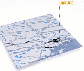 Places with similar names to Järved, Sweden ::
// Gervide (PT)
// Jirighāt (IN)
// Giriftu (KE)
// Gīrveh Dāghī (IR)
// Jauro Voti (NG)
// Jereveta (MZ)
// Gerevaudi (PG)
// Gervet (HT)
// Jerifat (MA)
// Jrifat (MA)
Disclaimer :: Information on this page comes without warranty of any kind |
||
|
Where is Järved? Elevation and coordinates ::
Latitude (lat): 63°16'0"N Longitude (lon): 18°46'0"E
(map arrows pan, magnifying glasses zoom) |
||
|
Visiting Järved? Hotel/Accommodation ::
Book a hotel in Järved Travel Guide ::
Buy a travel guide for Sweden rental cars ::
car rental offers GPS waypoint ::
download a GPX waypoint (PoI) of Järved for your GPS receiver
|
||